Namibia is a land of spectacular landscapes, endless skies, barren deserts, rugged mountain ranges and breathtaking wildlife - participants of this self-drive safari experience something of all this.
On this trip, we combine the Namib Desert with the wildlife-richest areas of Namibia, the Etosha National Park and the Caprivi / Kavango. You will first drive south to the dunes of Sossusvlei and the beautiful Namib desert. The road then takes you all the way to Swakopmund, from there around the Brandberg massif to the rock engravings and desert elephants of Twyfelfontein and the volcanic rock landscape of Damaraland. You will cross the wildlife-teeming Etosha National Park. You then drive further east into the Kavango area, where the Okavango and Kwando rivers open new perspectives with many activities taking place on the water. At the eastern end of the Caprivi you leave your rented vehicle behind. Our guide will transfer you over the border to Bostwana and the Kasane / Chobe area. The Chobe River is home to Africa's largest population of elephants, best explored on one of our houseboats that cruise the Chobe River. Your journey ends with a stay at Victoria Falls, from where you can visit the mighty water falls.
This self-drive journey starts in Windhoek, where you pick up your vehicle. We definitely recommend a first night in Windhoek, which gives you enough time to buy some snacks and water for the trip.


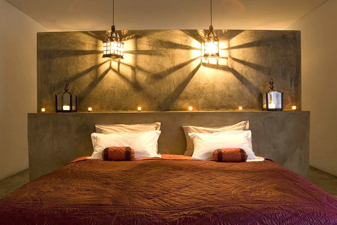
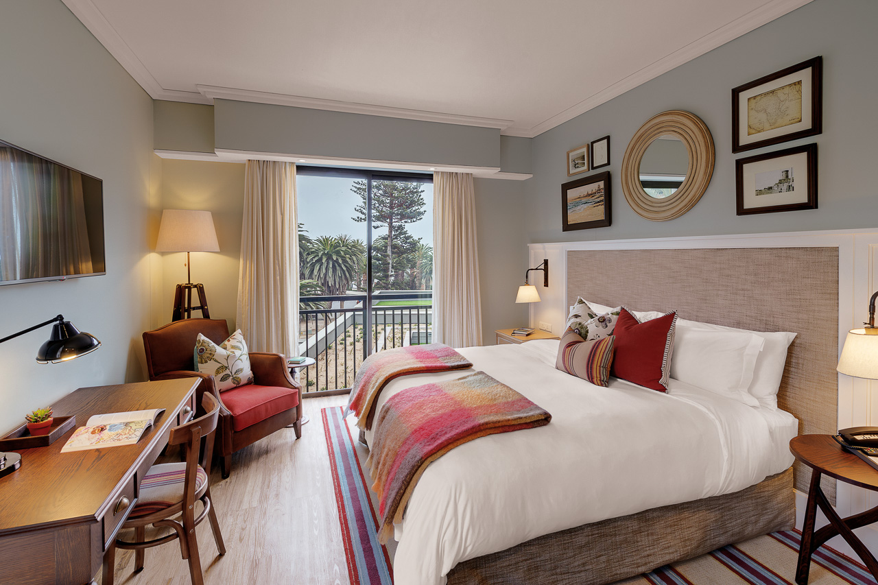
Accommodation The Olive Grove is a charming, intimate guesthouse with eleven beautifully appointed rooms, each equipped with a minibar, air conditioning/heating, safe, TV and hairdryer. Its five standard rooms are located on the lower storey; its luxury rooms with access to a terrace are on the upper storey. Those in search of the ultimate luxury experience can book the 80 m2 executive suite, which comes with its own lounge.
A breakfast buffet is included; lunch and à la carte dinner is either served in the restaurant or on the veranda. The Olive Grove takes great pride in its cuisine and is certain to delight even the most discerning of palates.
A swimming pool provides the perfect place for a cooling dip.
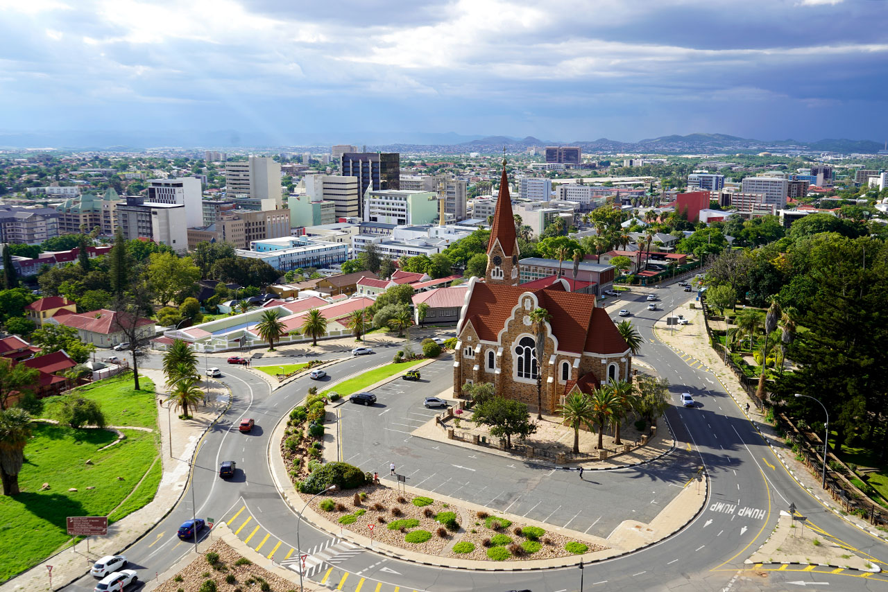
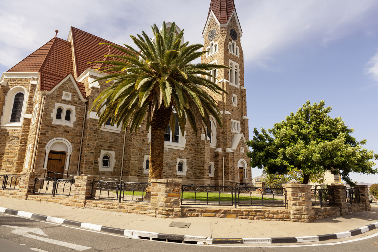
Windhoek is situated in a hilly environment, in the Khomas Highland region, about 1600 m above sea level. The international airport is approx. 1 hours’ drive east, as the city itself has no suitable place for a major airport. It is also served by a small airport (Eros), which is used by lighter aircraft.
The city doesn’t offer enough to warrant remaining for days, but it is the perfect place to spend a night at the beginning or end of a tour, and it is well worth having a look around. Windhoek’s size and straightforward layout means it’s easy for self-drivers to find their way around, and therefore the perfect place to stock up on provisions.

Accommodation
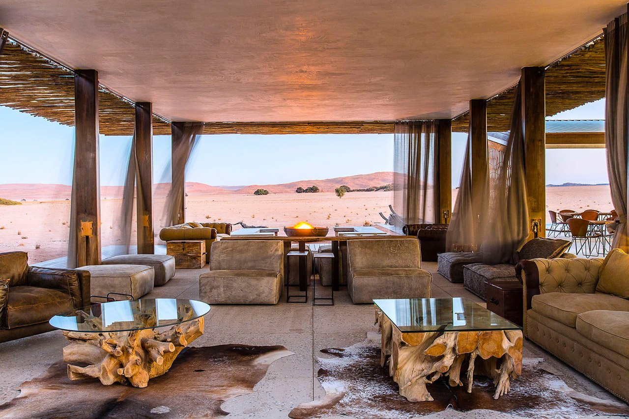
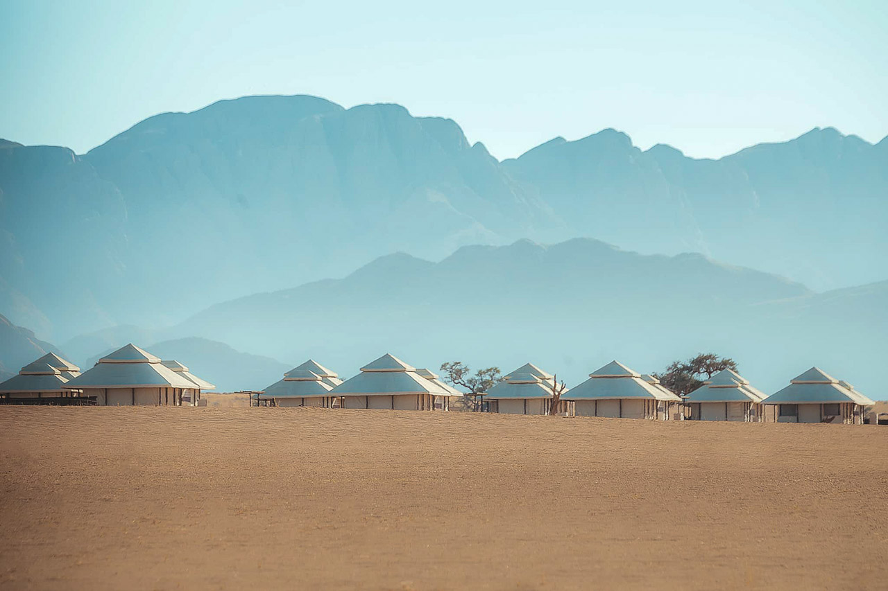
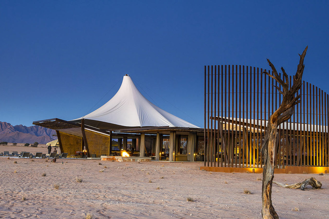
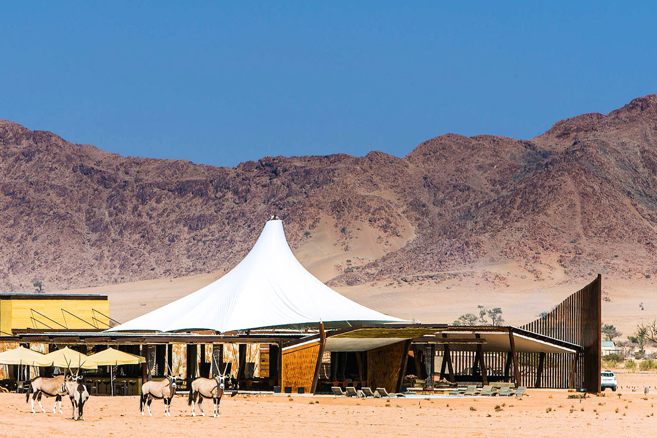
Dead Valley Lodge is one of only two lodgings located within the Namib Naukluft Park, making it a good option for those who want to explore the dunes themselves. The last 5km of road to Sossusvlei is just a sandy track and can be challenging.
The lodge offers twenty free standing, climate-controlled, luxury tented chalets with panoramic views of the Namib Desert and its towering red sand dunes and rugged mountain ranges. The bathroom is located in a separate chalet on the same platform and has a large shower, toilet and a double washbasin.
The main area has a an open-plan design with natural materials such as wood, stone and canvas that blend in very nicely with the desert environment. There is a large lounge area, an open fireplace, a swimming pool, bar and a restaurant that serves Namibian cuisine.
Since the lodge is located inside the park, visitors are not bound to the opening and closing times of the park gate and have more flexibility in terms of visiting Sossusvlei. Guests of Dead Valley Lodge may reach Dead Vlei even before sunrise.
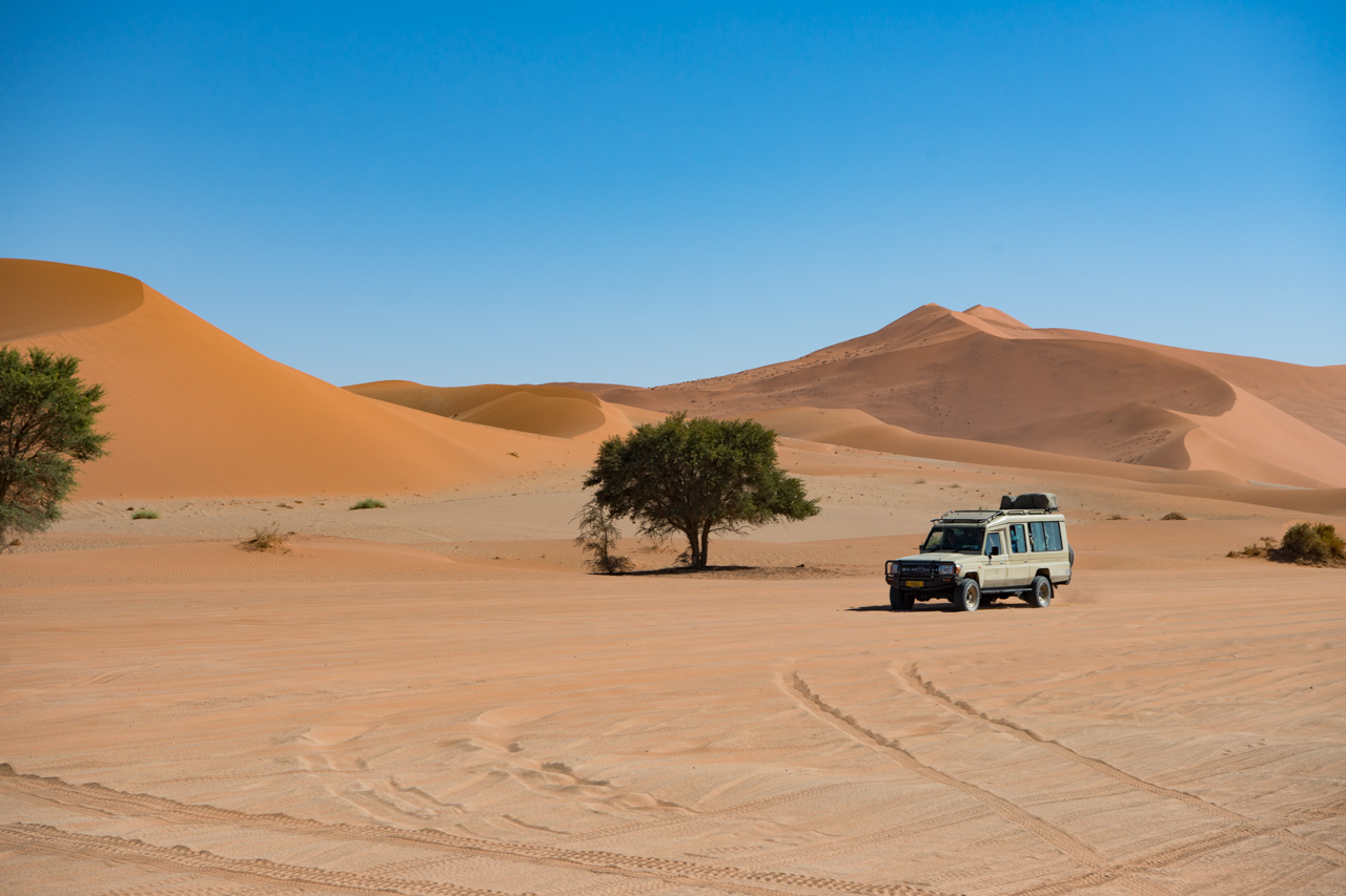
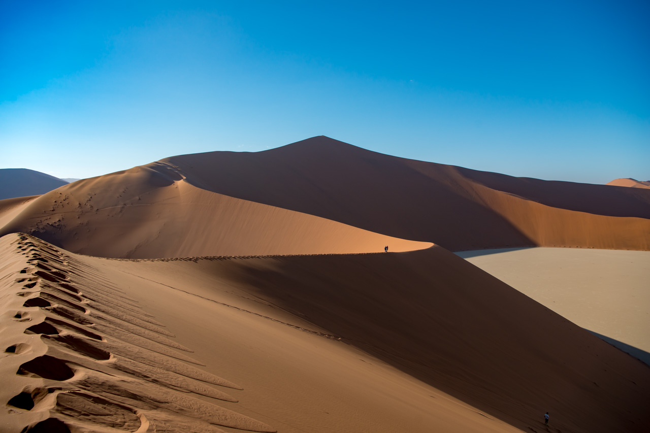
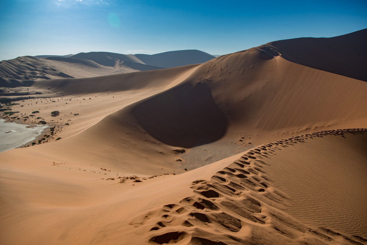
Sossusvlei is the area most associated with Namibia: Red dunes as far as the eye can see (up to 380 m high, coloured red by the clay-rich sand) and dead trees in the Vleis or pans decaying slowly at the will of the arid climate. The Vleis were created by the Tsauchab River, which probably once flowed to the Atlantic some 50 km away. The whole Sossusvlei region is quenched with water during those very rare years when a good amount of rain falls, prompting bushes and flowers to spring up everywhere.
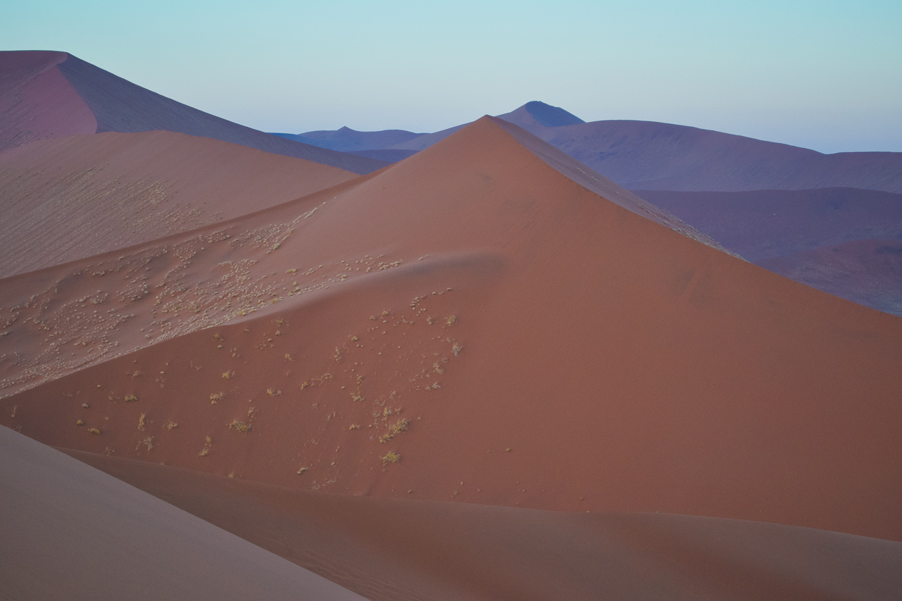
Sossusvlei is also the place most commonly associated with Namibia. Its red dunes stretch as far as the eye can see (up to 380 m high, coloured red by the clay-rich sand) and the desiccated trees in the vleis (salt and clay pans), which decay slowly due to the arid environment, are typical of the region. The vleis were created by the Tsauchab River, which most probably flowed into the Atlantic 50 km away. Very rarely, a torrential downpour will see the vleis disappear under water – a spectacle that very few get to see. .
The Namib itself is a product of the Orange River in the south, which carries the red sand of the Kalahari to the ocean. The Benguela Current takes the sand north, where the prevailing winds have blown it back inland over millions of years, forming the Namib Desert.
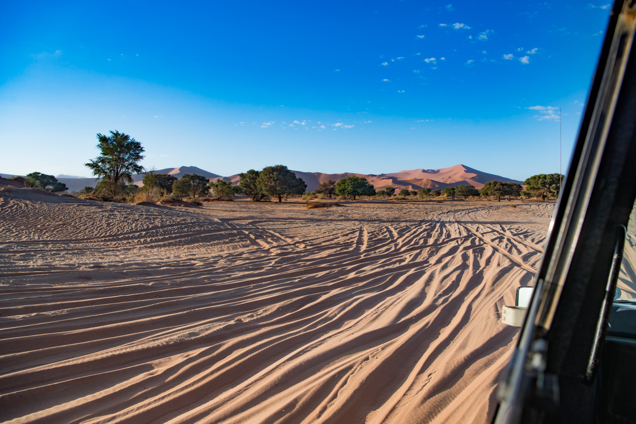
Sossusvlei is situated in the Namib Naukluft Park and thus subject to very strict regulations. The park opens its gates at sunrise and all visitors are required to leave again by sunset. The distance between the park entrance and the Sossusvlei car park, however, is a good 60 km, most of which is tarred. From here it’s only possible to reach the second car park, right next to the Sossusvlei, in a 4x4, on foot or using the shuttle service. There are also other vleis in the area in addition to the Sossusvlei, including Dead Vlei, with its famous dead trees, and somewhat further away, the so-called Hidden Vlei, which requires a good trek to get to.
The most famous dunes are Dune 45 (170 m high), which is located 45 km from the entrance to Sossusvlei, and then Big Daddy, the largest dune, and his partner, Big Mama. Visitors are of course allowed to scale the dunes, and the effort is worth it. The way up is quite strenuous – but this also means that the way down is easy!


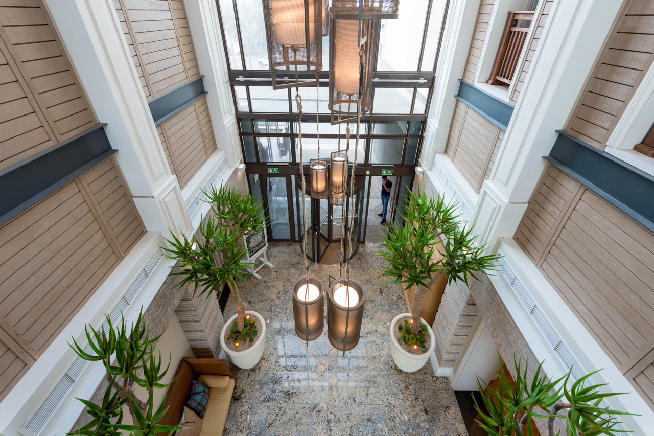
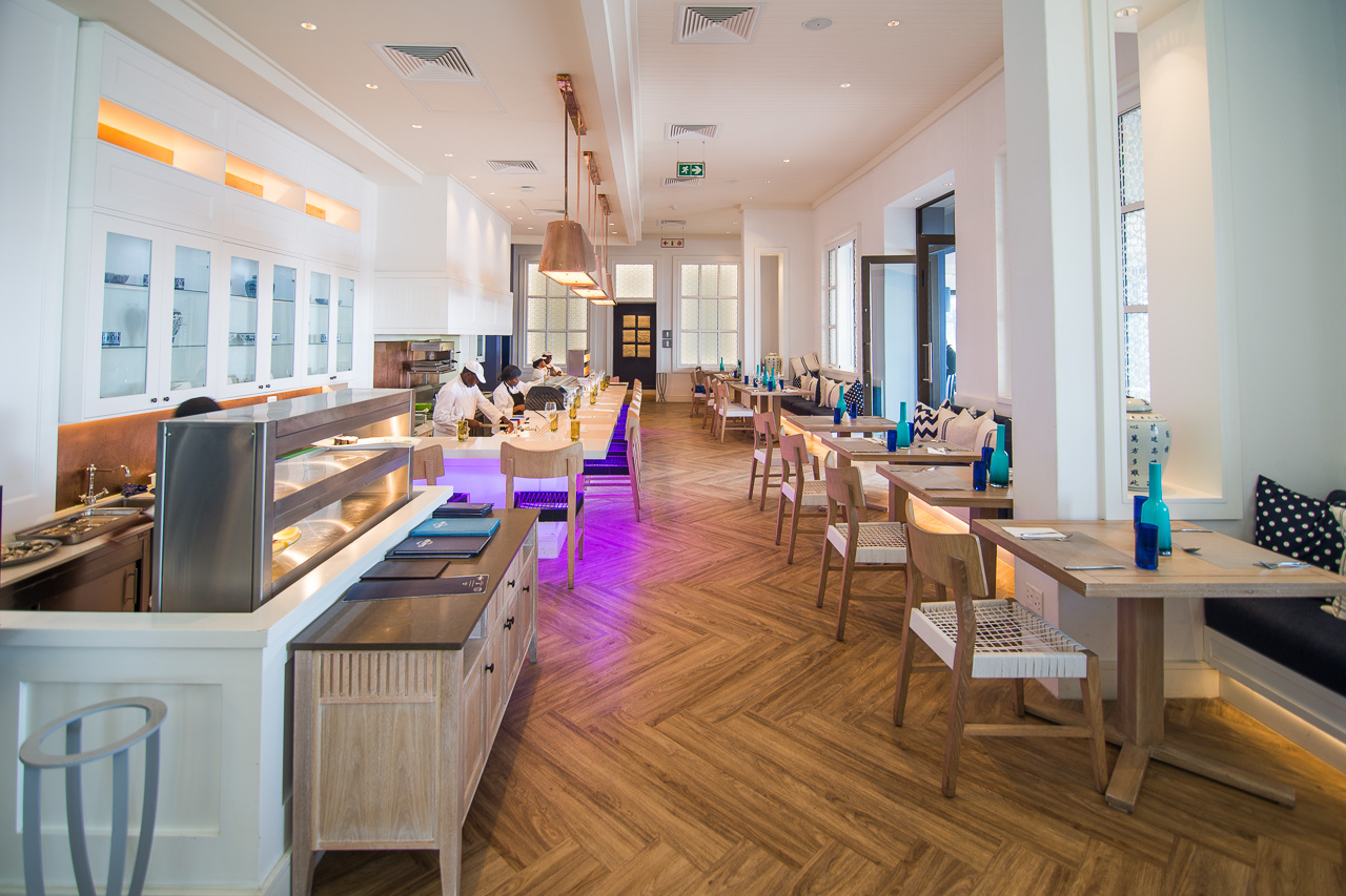
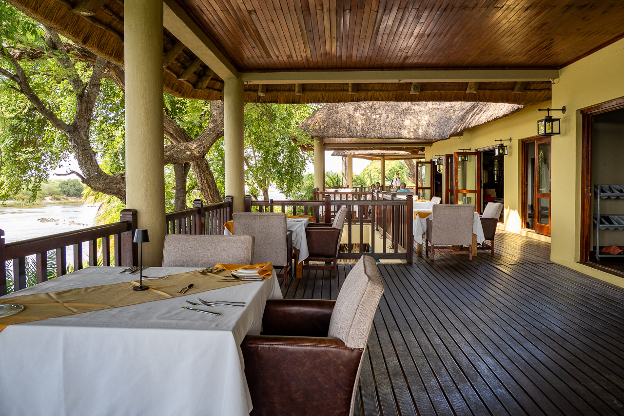
Accommodation The new Strand Hotel has set a new standard in Swakopmund. Uniquely located on the iconic and historic Swakopmund Mole and surrounded on three sides by the Southern Atlantic Ocean its 125 rooms and suites make this hotel one of the larger ones in town, but of those certainly the one with the best seaside location. All rooms have tea & coffee stations, mini-bars, hair-dryers, TV’s, free Wi-Fi Internet access, telephones and air-conditioning.
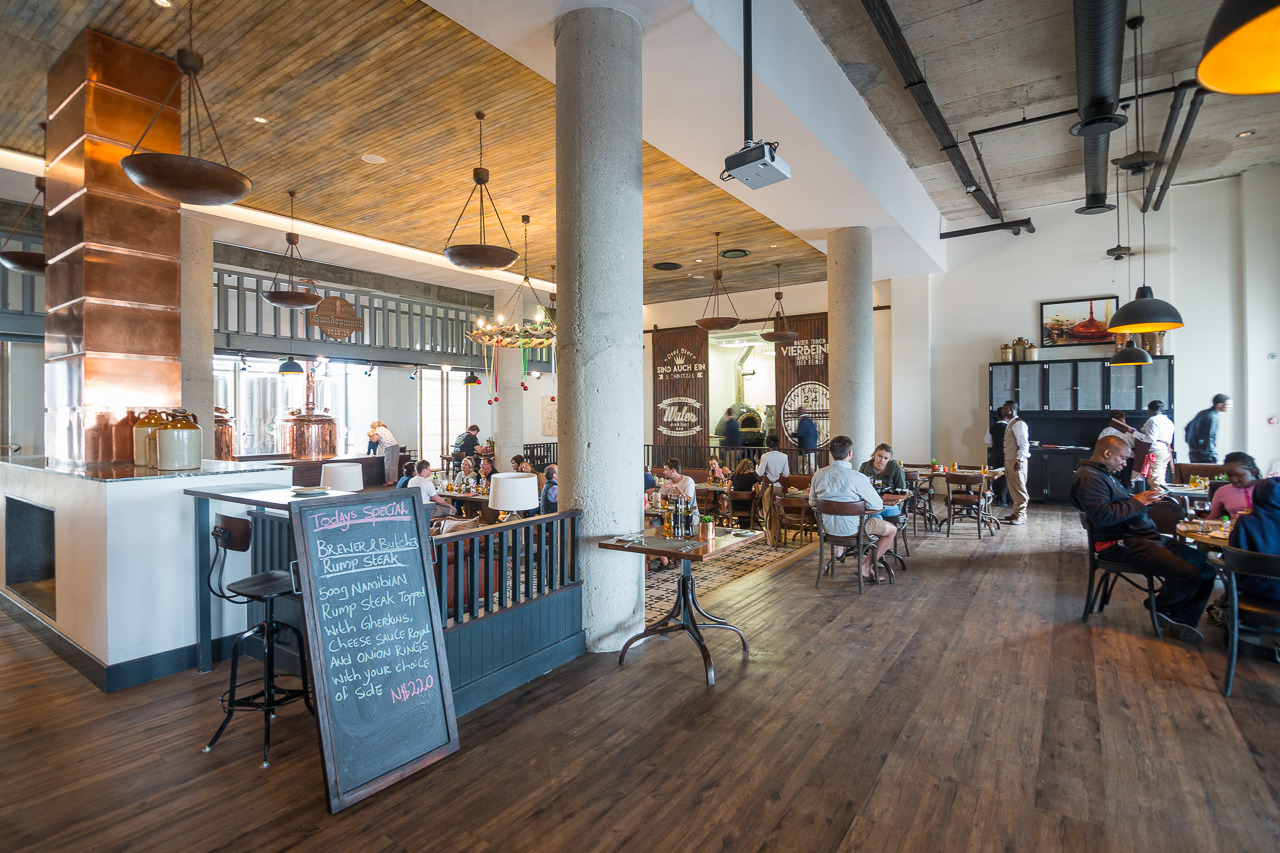
The Strand Hotel offers its residential guests and all casual visitors three exciting restaurants. The Farmhouse Deli is good for coffee, cake, sandwiches and fresh salads. The Brewer & Butcher welcomes beer and meat lovers. The Ocean Cellar caters for guests who prefer seafood, sushi, oyster and a glass of fine white wine.
The Strand Hotel is destined to become the social epicenter of Swakopmund for locals and tourists alike.
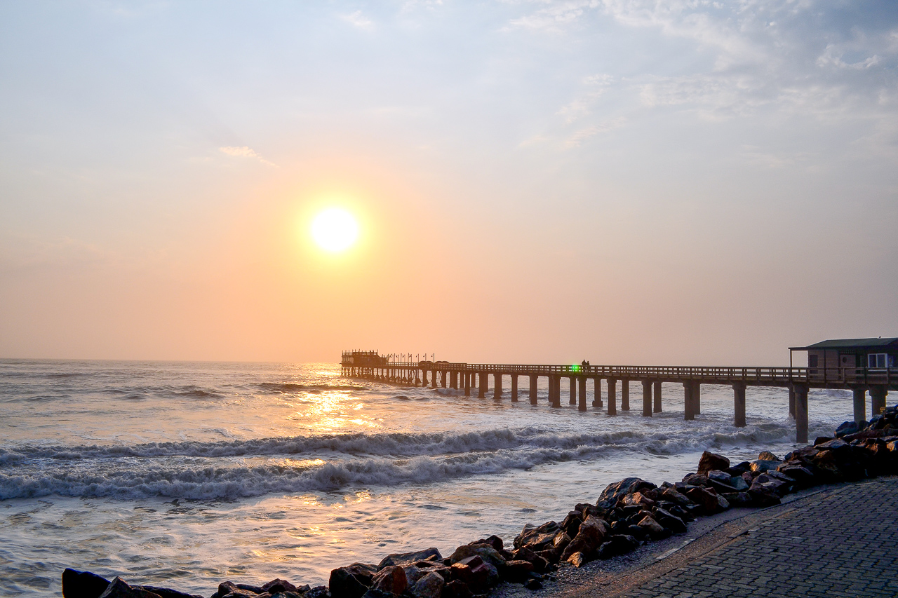
Swakopmund was the centre of German colonial rule, and relics of this chapter of its history can be found around every corner. Most noticeable of these is the long jetty, which stands witness to the German’s activities in this area and their attempt to create a usable port. Unfortunately, Swakopmund turned out to be wholly unsuitable for the task. Walvis Bay is a natural bay just 30 km south. It was occupied by the English as early as 1795, and later became a fish-processing industrial town under South African rule.
Swakopmund is charming. The old part of town is very pretty and offers several cafes, bakeries and, of course, the unavoidable beer houses. Time appears to have stood still in many parts, and it’s difficult not to keep rubbing your eyes in wonderment at the mix of German and African.
There’s a lot to do if you stay at Swakopmund: take a day trip southwards along the coast to Sandwich Harbour, hop on a boat at Walvis Bay and wait for the seals and pelicans to greet you, Kayak with seals, jump on a quad bike for a ride through the dunes, or just take a stroll along the beach and enjoy a tasty meal in one of the great restaurants. Swakopmund’s most famous landmark, the jetty, has been renovated and now boasts the appropriately named ‘Jetty 1905’ restaurant at its end.

Accommodation
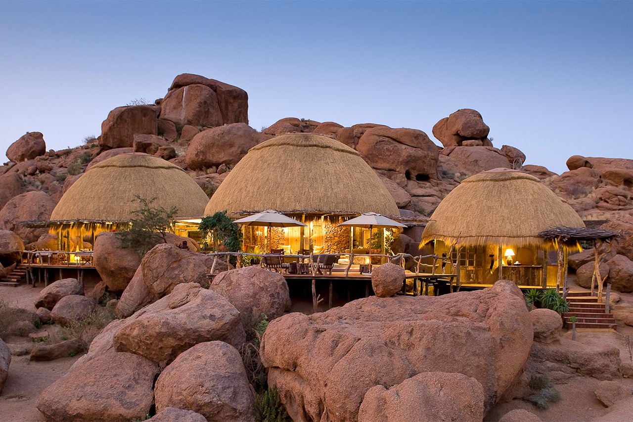
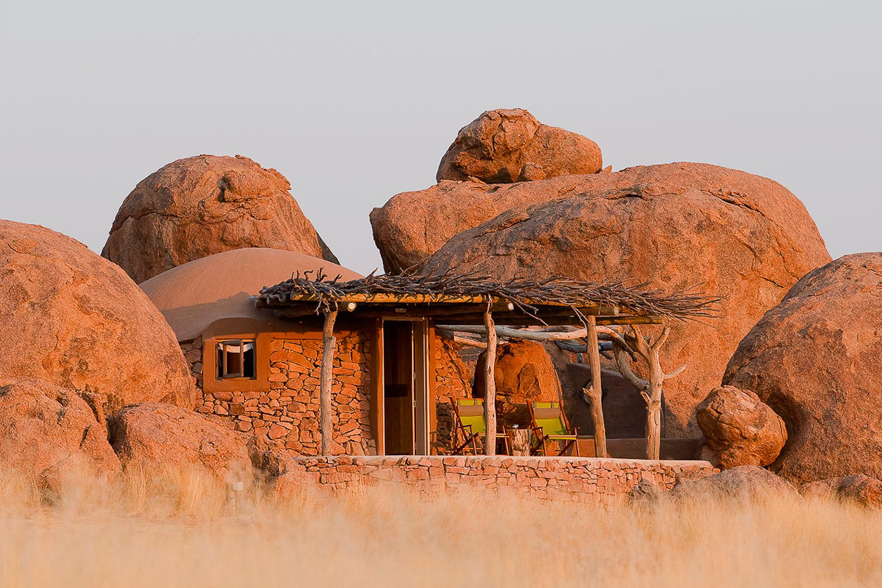
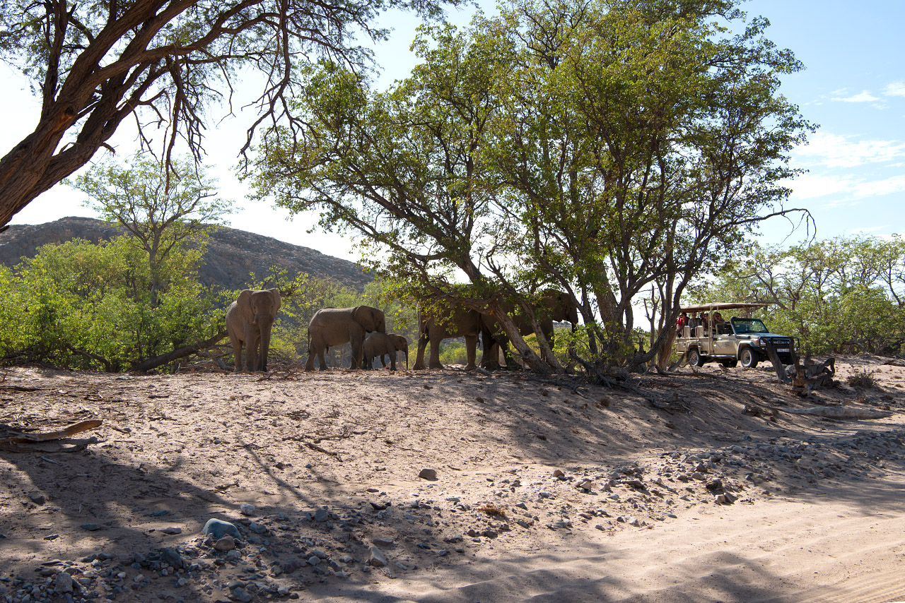
The nine bungalows at Camp Kipwe are inspired by the granite boulders scattered about them, and blend in perfectly with their rocky environment. Made of clay and stone, the walls exude a comfortable, organic feel. The adjacent open-air bathrooms are creatively integrated into the rock face, and despite their exposed nature offer absolute privacy.
All bungalows have a veranda where you can sit outside and reflect on the day. Some of the rooms have also been extended with a canopy under which there is a dome tent with space for two children. Alternatively, these beds can be placed in the room if the parents prefer.
In addition to its nine bungalows, the lodge also offers the Kipwe Suite equipped with additional lounge and bathtub with spectacular view and two Luxury Suites with extended deck, private plunge pool and outdoor sala.
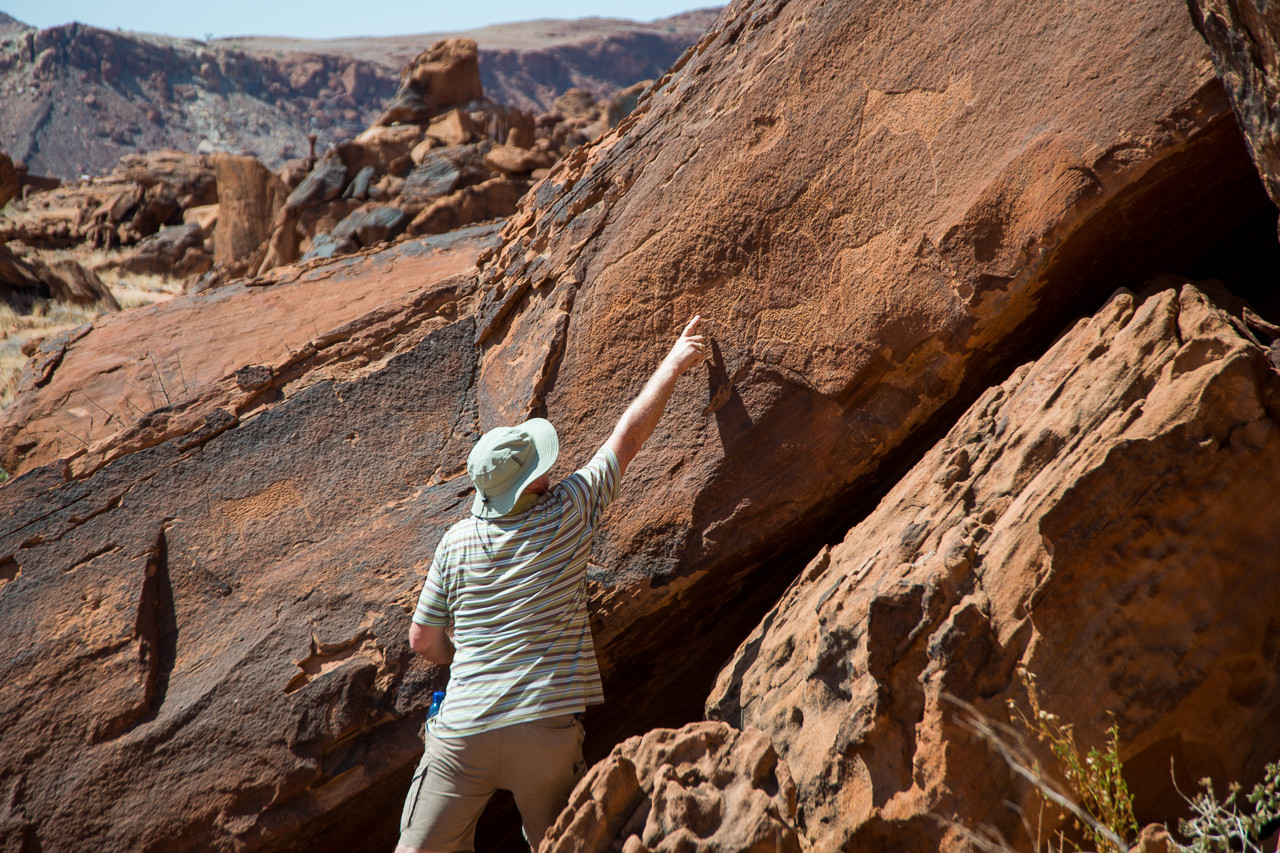
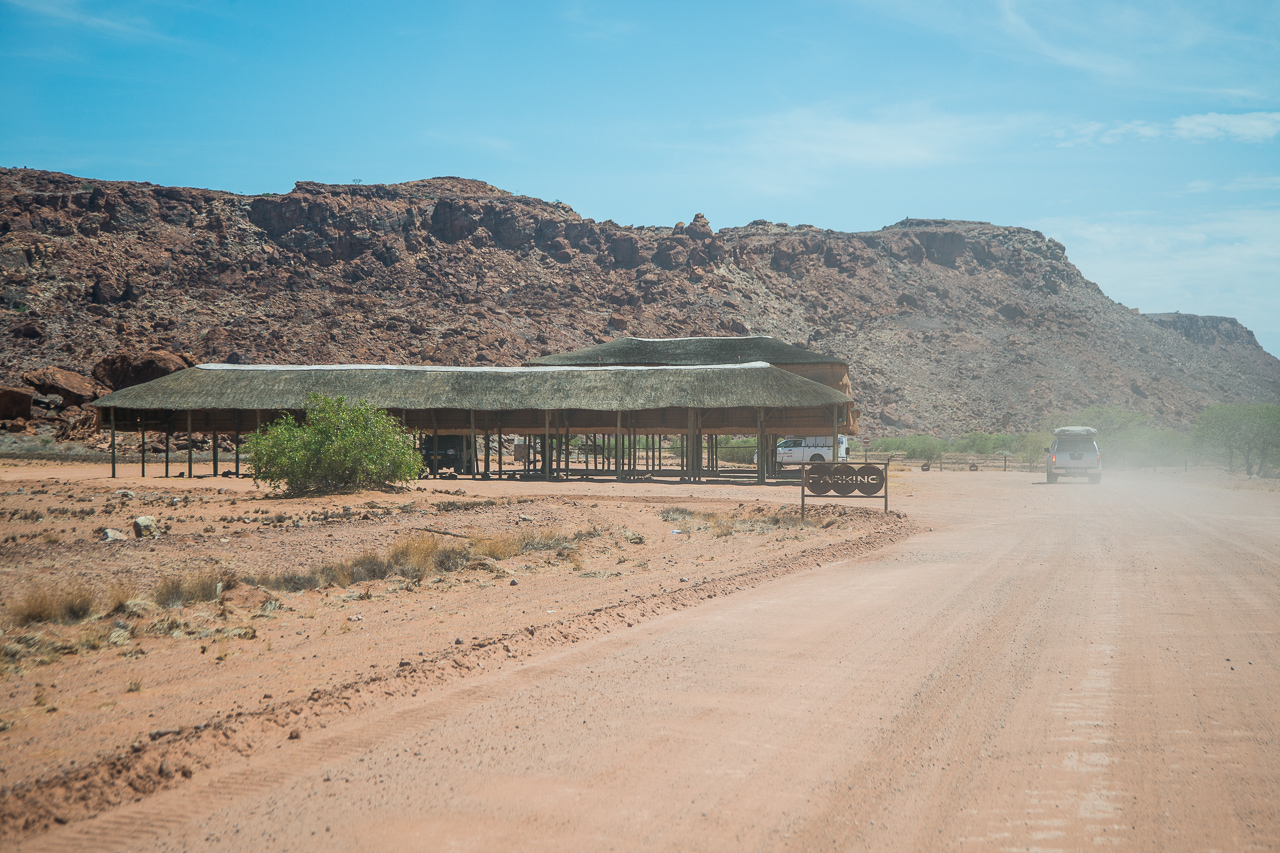
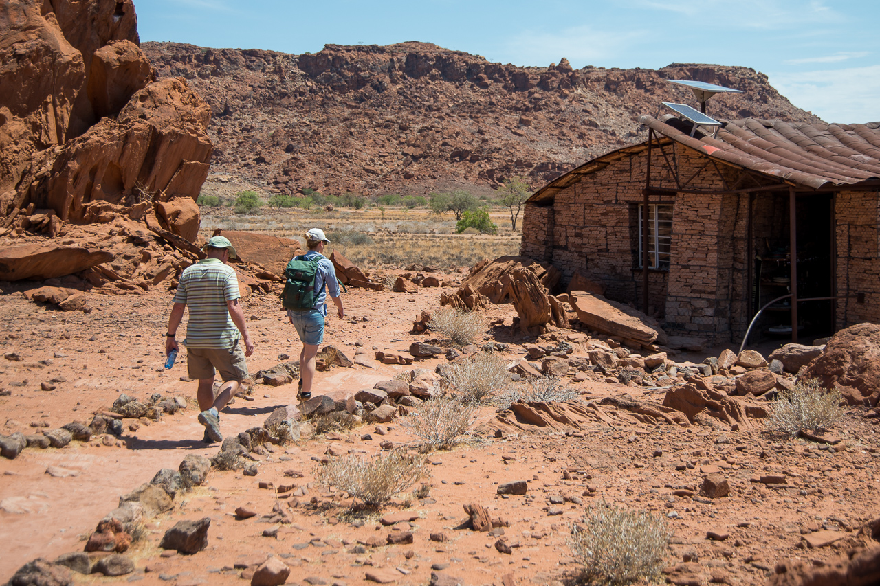
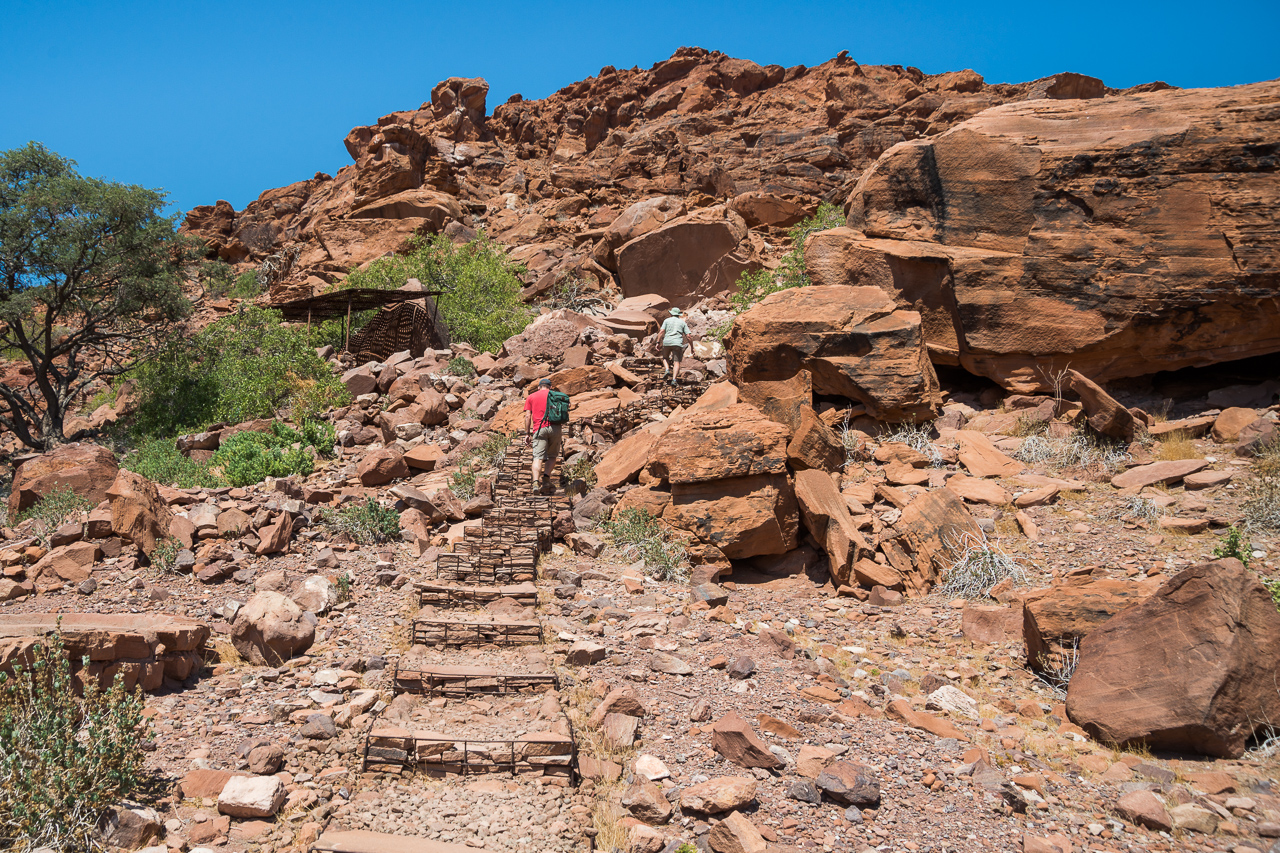
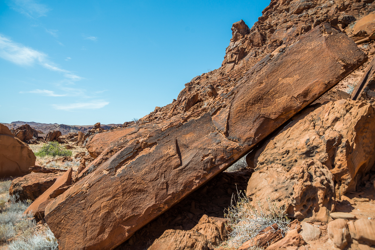
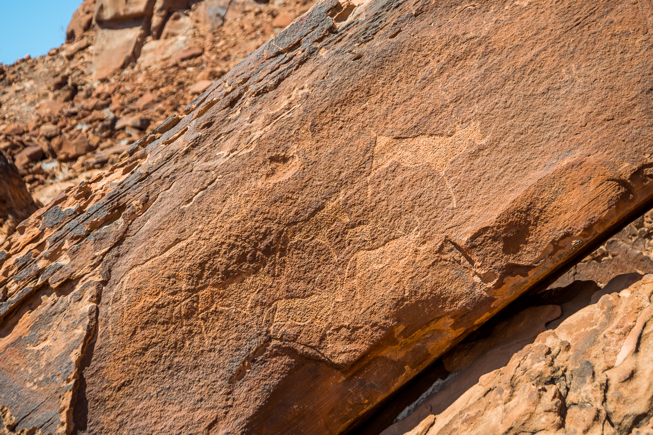
Twyfelfontein was declared a World Heritage Site in 2007 because of its significance as one of the most important sites of African rock engravings. The area is home to one of the few watering holes in the entire region, and one which the local farmers didn’t find particularly reliable: roughly translated, the name Twyfelfontein means ‘sometimes there’s water, sometime’s there isn’t’!
Today, some 40’000 guests from around the globe visit the rock engravings, which has made Twyfelfontein one of Namibia’s destination hotspots and therefore quite busy – visitors can’t expect to have the rock engravings all to themselves.
This region had been familiar to its ancient residents for a long time: they gathered close to the only source of water during the dry season, carried out their rituals, and drew and carved their experiences onto and into the slabs of rock around them. The naturally occurring iron oxide in the sandstone formed a protective layer (the so-called ‘desert varnish’) over the rock engravings. This layer has slowed down the weathering process and allowed us to admire these thousands-of-years-old works of art today. Many of the engravings depict hunting scenes with giraffe, antelope, zebra, ostrich, rhino, elephant and lion – and interestingly enough, also a seal! Humans are rarely depicted. The drawings are often surrounded by geometric patterns.
To avoid contamination and vandalism, guests may only visit the area with a guide, who will highlight the most famous motifs, including the lion with a kink in its tail and the dancing kudu. The tour takes about an hour for the first motifs, and a further hour if you wish to see the rest. It is best to visit in the early morning or late afternoon in order to avoid the worst of the heat.


Accommodation
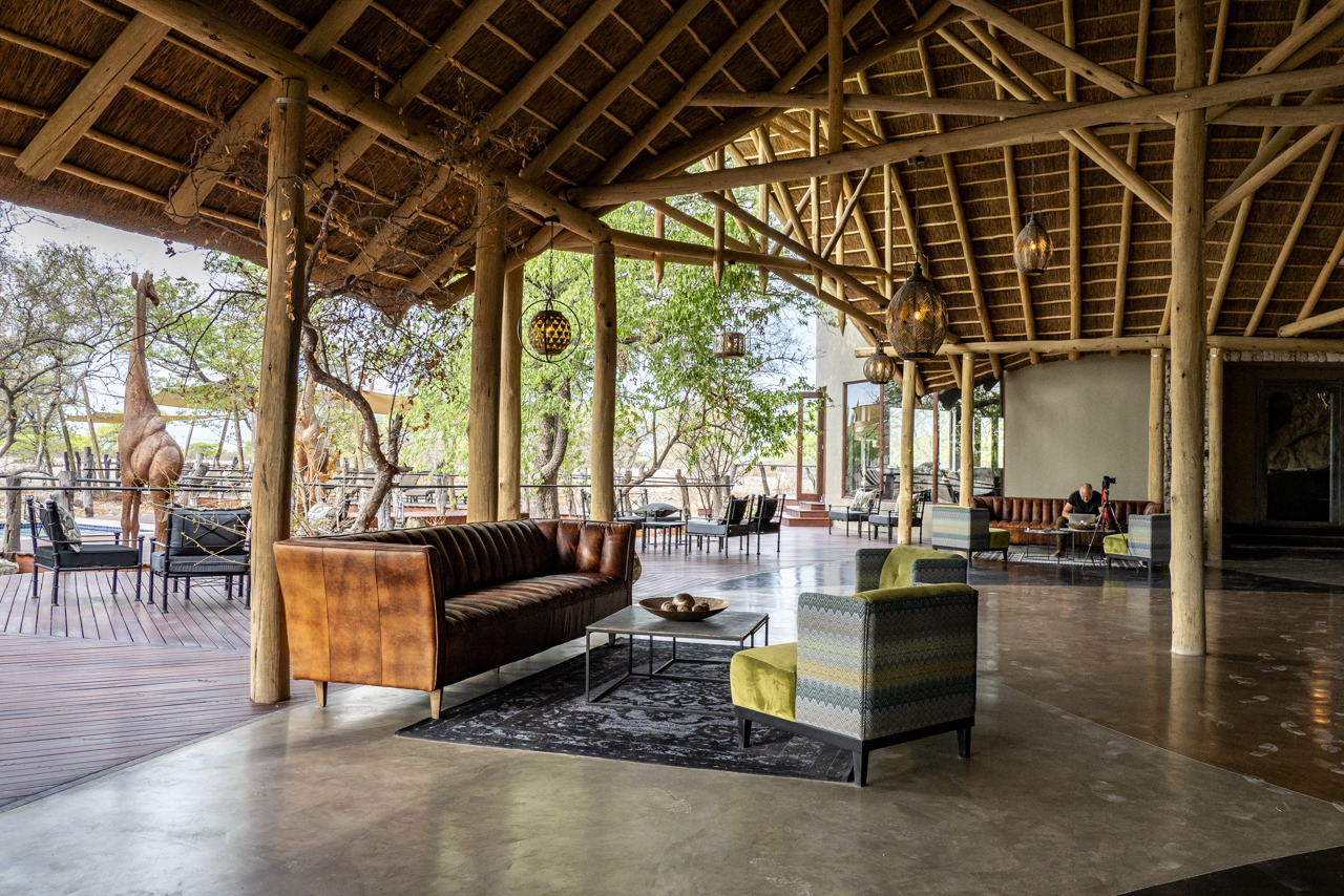
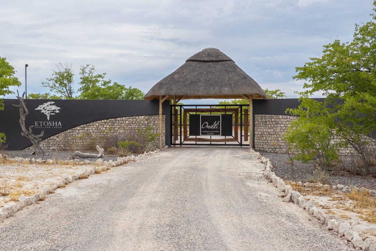
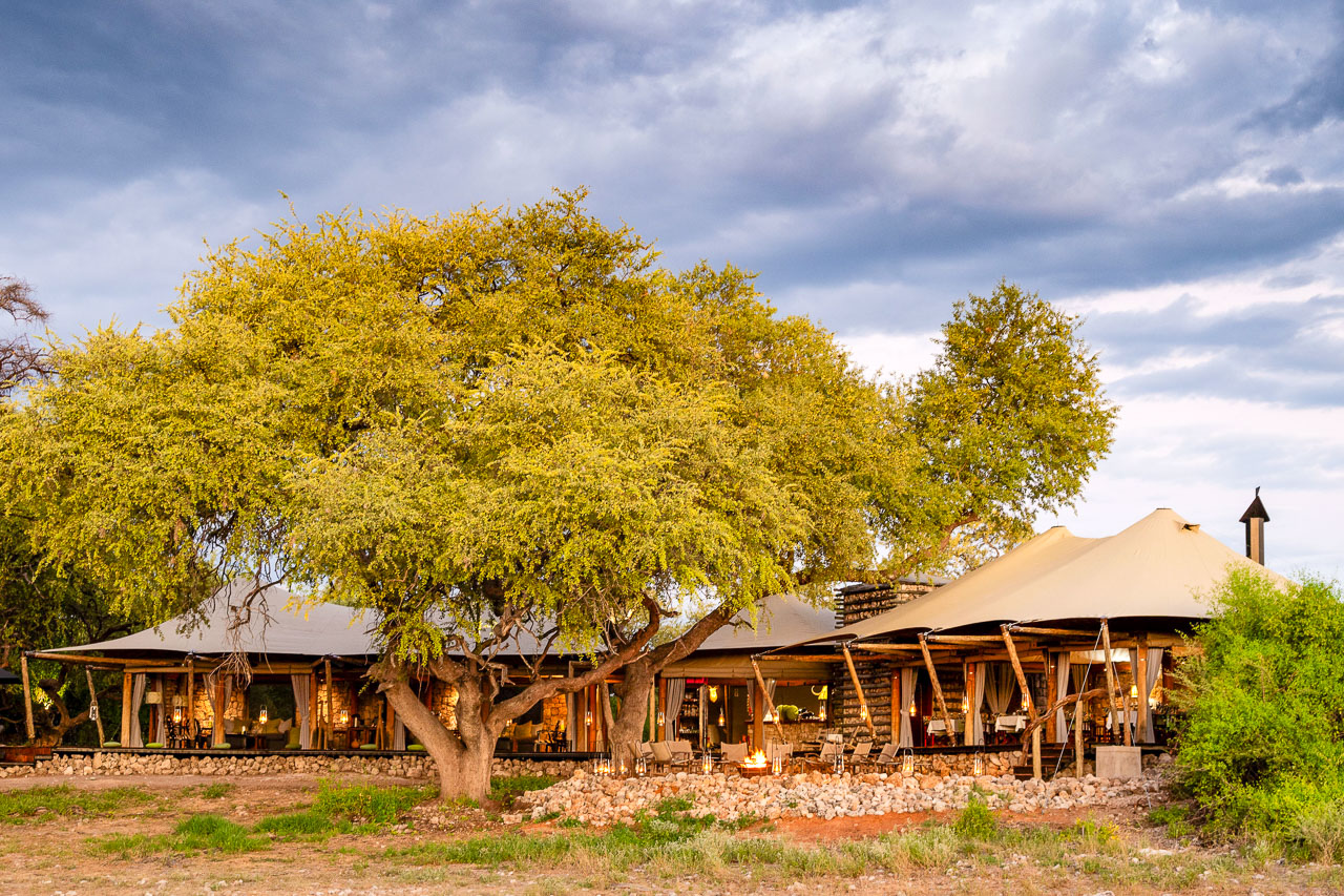
Etosha Oberland Lodge offers an ideal base for exploring Etosha National Park. The lodge is designed in a modern safari style and offers 20 tent chalets that are pleasantly private and spacious. Each guest unit has an ample bathroom, an open lounge and private seating area as well as air conditioning, fridge and coffee/tea making facilities. The required power is generated by the lodge‘s own solar system. There are also three family rooms with an extra bedroom.
The main building of Etosha Oberland Lodge is surrounded by tall mopane trees. The restaurant and its terrace offer views of the waterhole, where animals may pass by anytime. Other amenities include a swimming pool, bar and a spacious lounge area with various sofa corners where guests can relax after their safari. The curio shop exclusively offers products by artists from Namibia.
Wifi both in the main building and in the rooms.
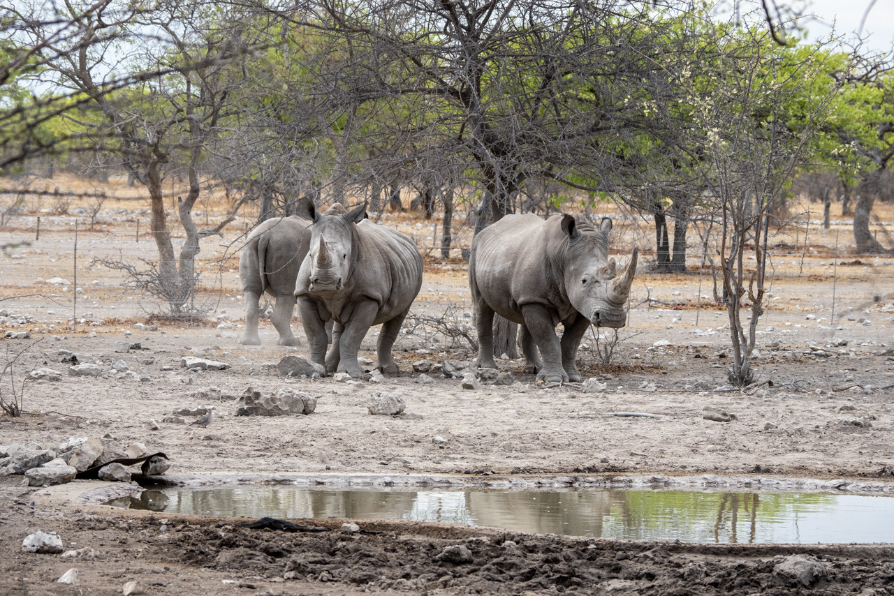
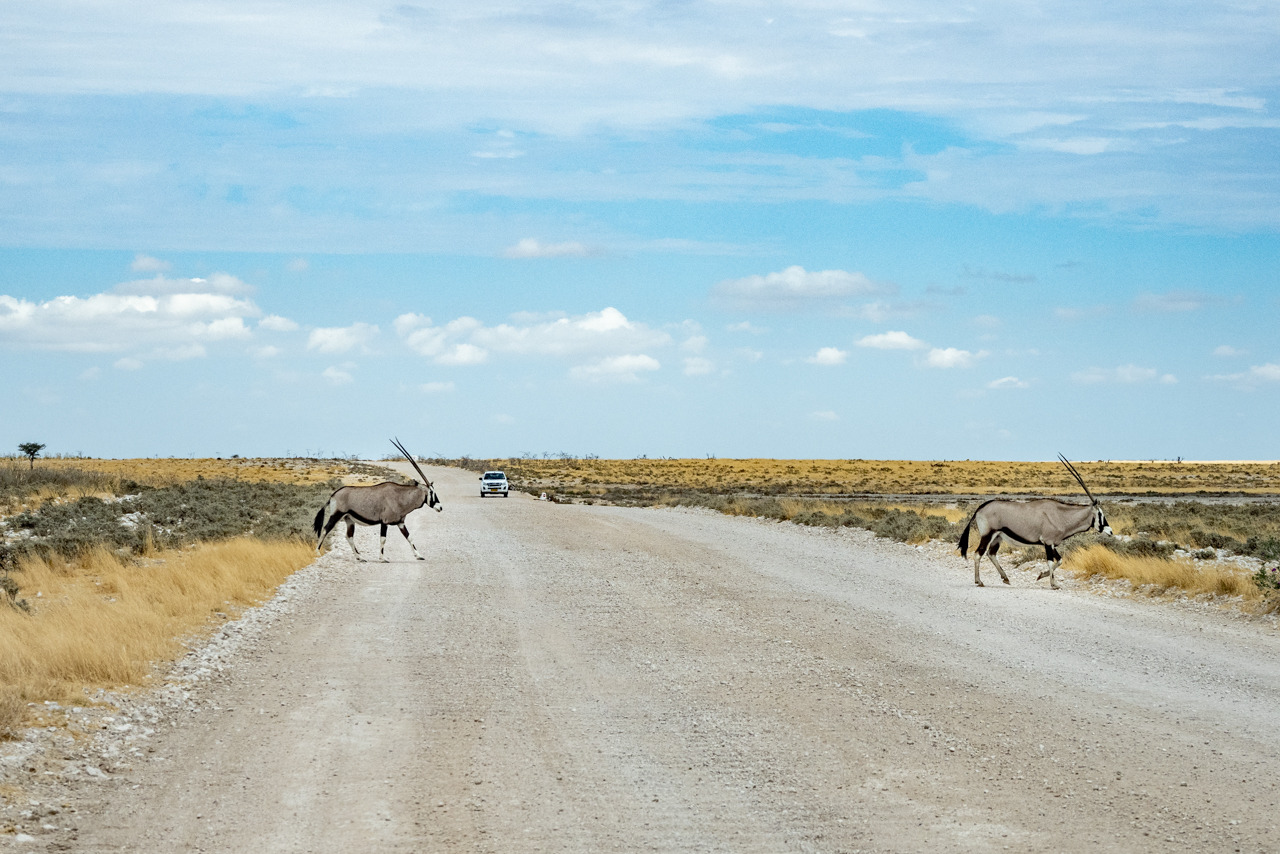
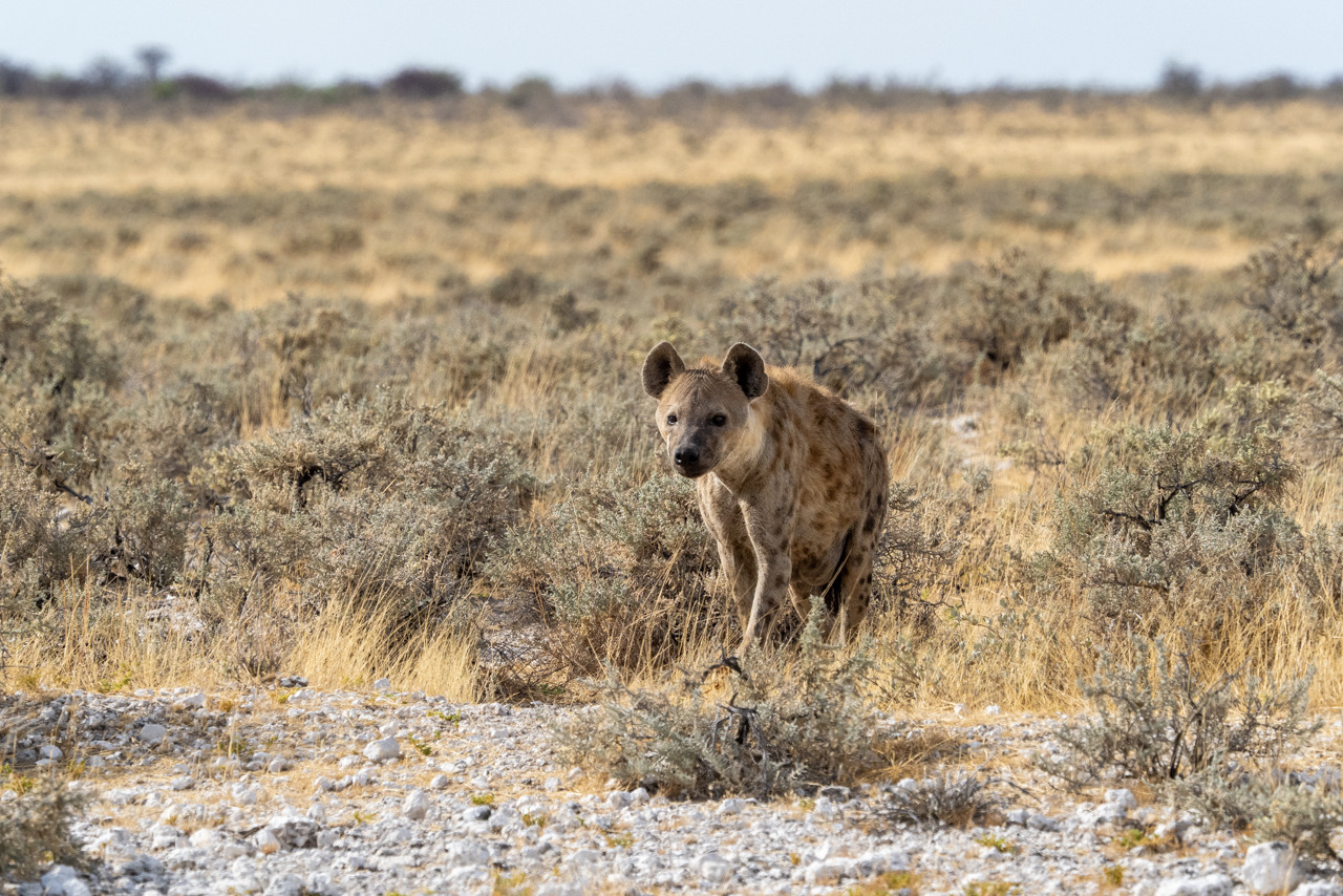
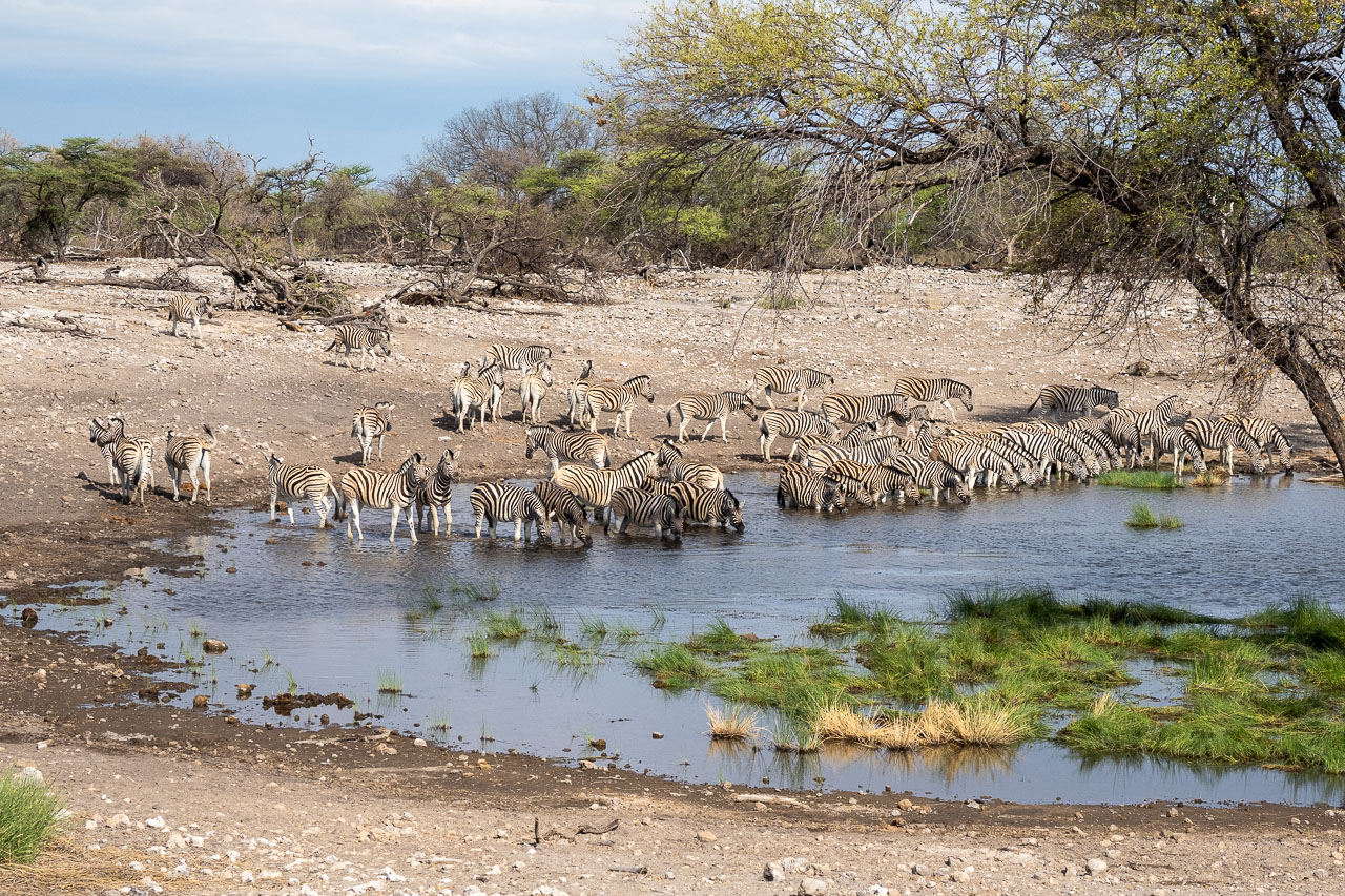
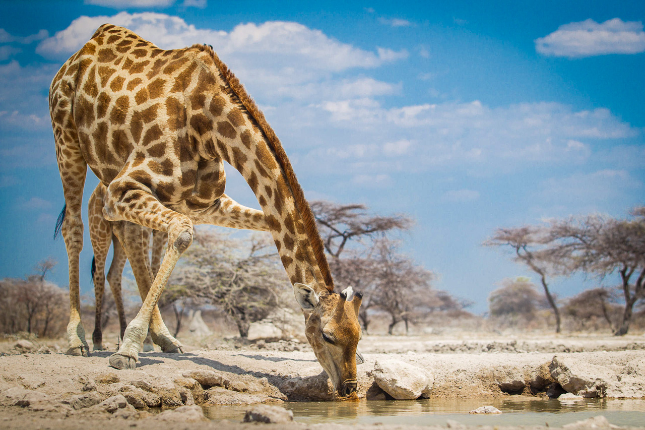
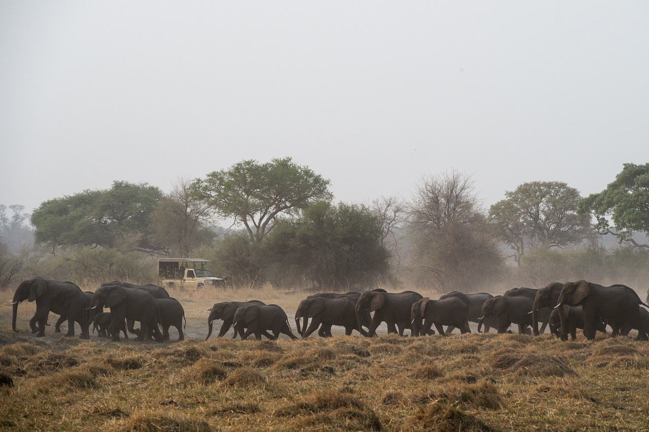
The Etosha National Park is one of the most important nature reserves in southern Africa. It exists since 1907 and covers an area of 22,270 km². The central and eastern sections consist mainly of various silvery-white shining salt pans, which have made Etosha famous. In the dry season the park, the animals and the vehicles are covered in a whitish haze of salt dust.
On the southern shore of the huge Etosha Pan (130 x 50 km) there are several waterholes, which magically attract the animals from the surrounding area during the dry season. The three large state camps Okaukuejo, Halali and Namutoni connect Anderson's Gate in the south with the von Lindequist Gate in the east. The western part towards Galton Gate is much more wooded and less frequented by visitors, but it also offers less trails to drive around and find wildlife.
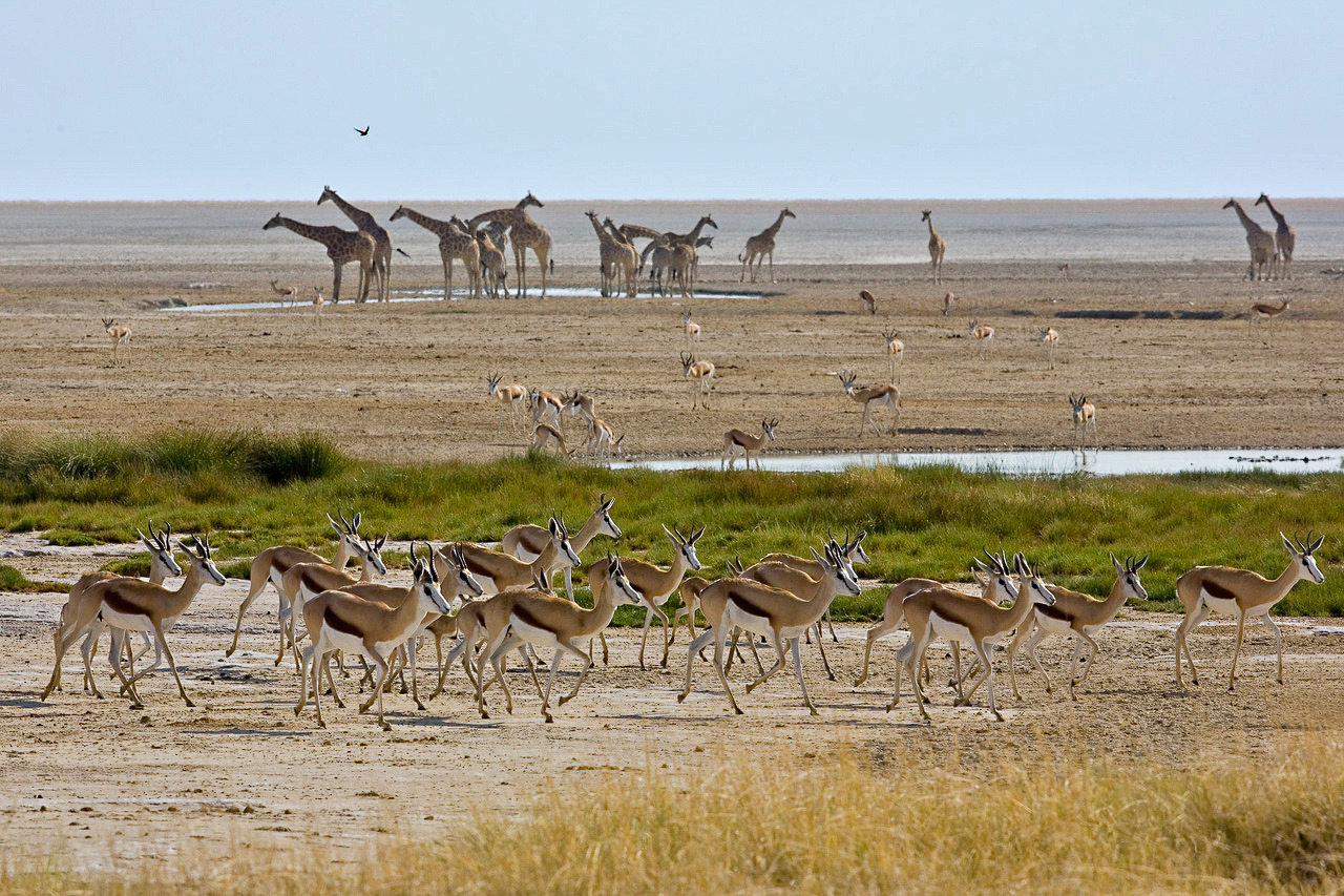
The park thrives mainly on these artificial waterholes, which attract countless animals in the dry season. With the onset of the rainy season, the animals are much less dependent on these waterholes and more difficult to find. The Etosha Pan itself can then contain up to 10 cm of water, and the park becomes more exciting for birdwatchers.
There are a few government camps in the park itself, most of which offer a less favourable experience. The good accommodation is located outside the park in private areas, in the east these are Mushara and Onguma, in the south it is the private Ongava area.
Namutoni and Okaukuejo are the two main camps at the eastern Von Lindequist Gate and the southern entrance to Etosha at Andersson's Gate respectively. The quieter Halali Camp is situated between the two. The state camps are very large and offer chalets, campsites, petrol stations and large picnic areas. If you are looking for a private experience, this is certainly not the place for you. Most of the roads run between these three camps and lead visitors to the various waterholes.
The western part of Etosha opened to visitors in 2011. This part of the park is very different from the area around the Etosha Pan, it has many more bushes and trees, less traffic, but also less to see.

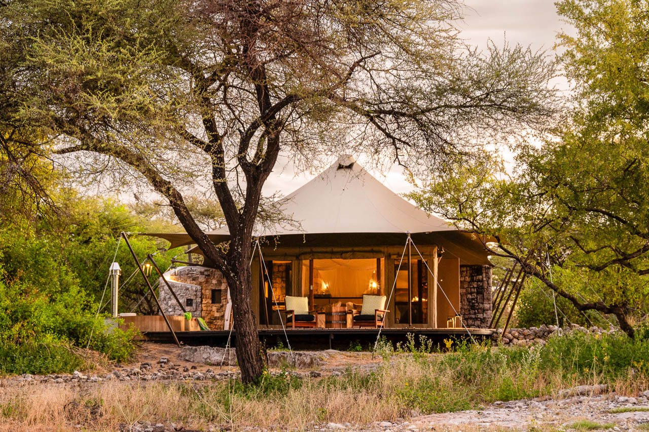
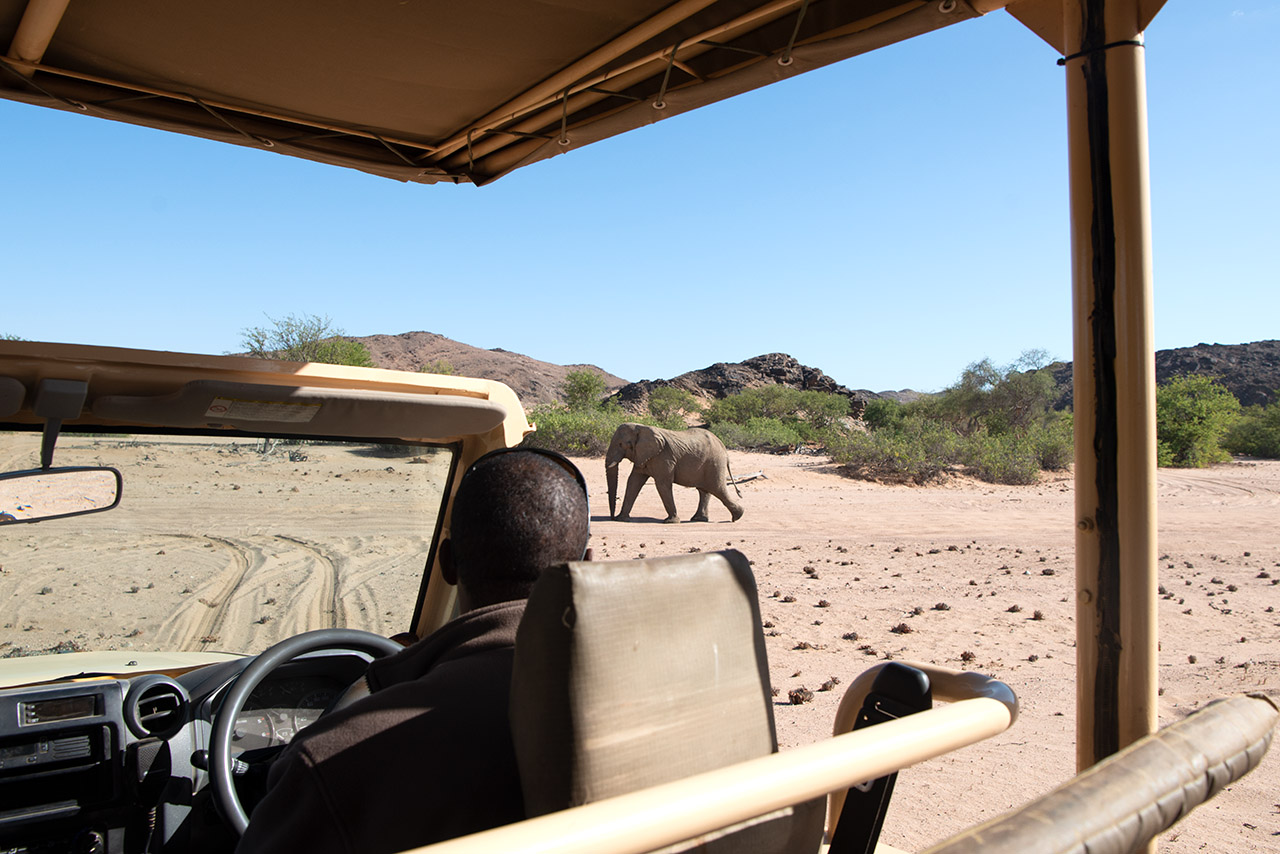
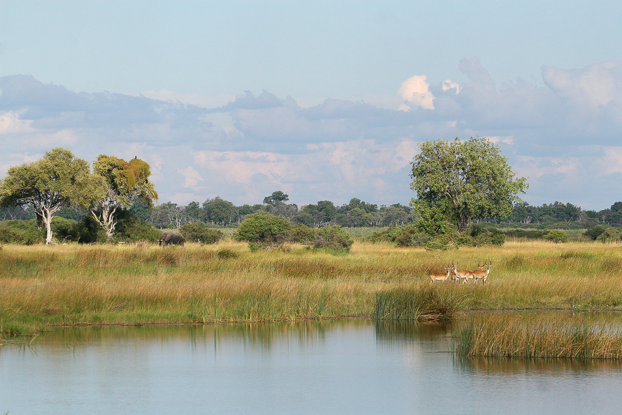
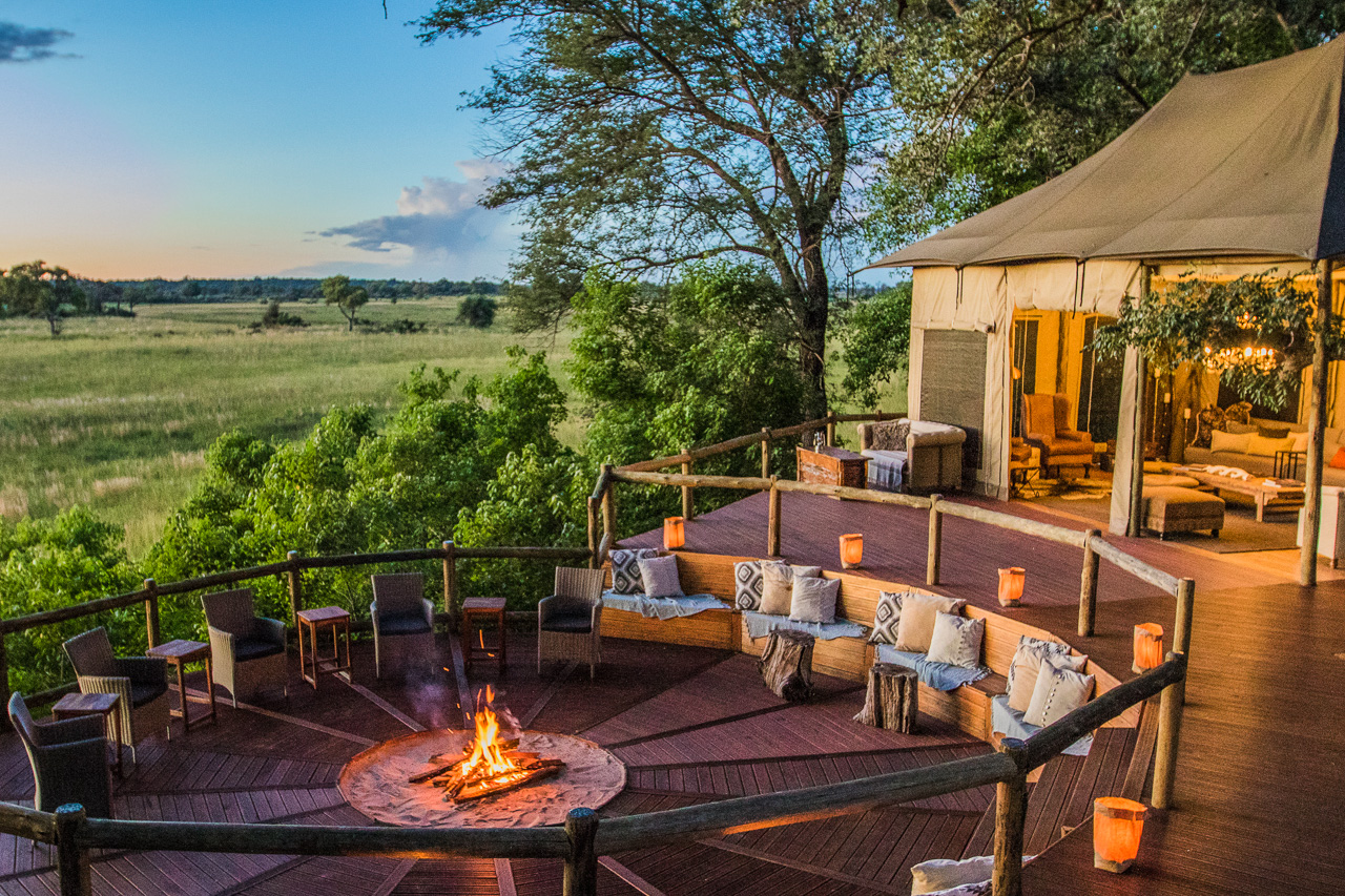
Accommodation Intimate and luxurious, Onguma Tented Camp offers uninterrupted views of a natural waterhole (lit at night) from anywhere in the camp. With a little luck, guests will encounter giraffe, jackal, antelope, zebra, wildebeest and maybe even a rare black rhino.
The main building houses a generously sized lounge, restaurant, wine cellar and swimming pool. The camp comprises just seven bright and spacious house tents, each with its own veranda, indoor and outdoor shower, elegant tin bathtub and separate WC. The light-coloured furnishings are designed to reflect the forms and colours of Etosha’s landscape.
The camp is unfenced, which means there is a minimum age requirement for our younger guests.
The Etosha National Park is one of the most important nature reserves in southern Africa. It exists since 1907 and covers an area of 22,270 km². The central and eastern sections consist mainly of various silvery-white shining salt pans, which have made Etosha famous. In the dry season the park, the animals and the vehicles are covered in a whitish haze of salt dust.
On the southern shore of the huge Etosha Pan (130 x 50 km) there are several waterholes, which magically attract the animals from the surrounding area during the dry season. The three large state camps Okaukuejo, Halali and Namutoni connect Anderson's Gate in the south with the von Lindequist Gate in the east. The western part towards Galton Gate is much more wooded and less frequented by visitors, but it also offers less trails to drive around and find wildlife.
Etosha National Park is Namibia's premier safari destination. Covering almost the same area as Switzerland, Etosha is one of the largest national parks in Africa. To the west of the park lay the silvery white salt pans and adjoining waterholes, which magically attract all kinds of wildlife during the dry season.

Accommodation
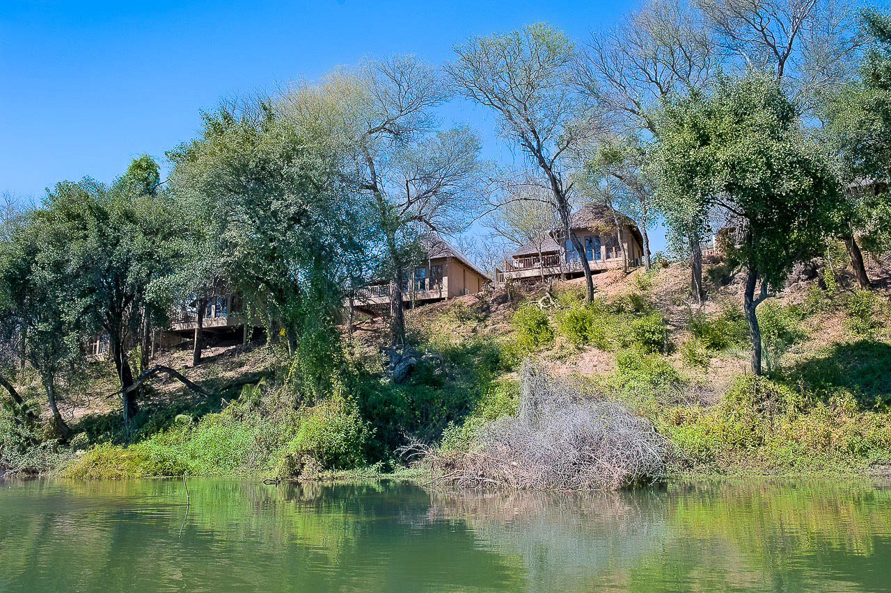
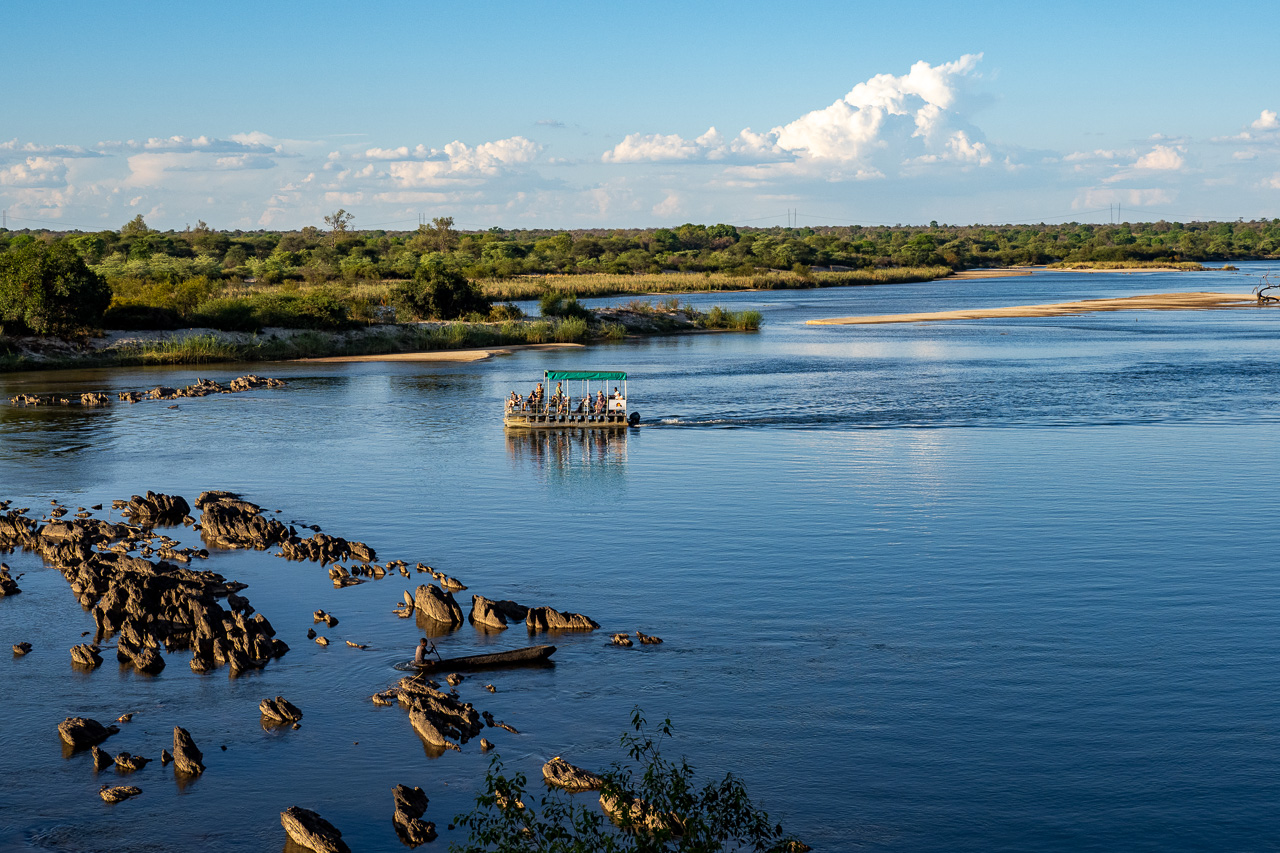
Built on the banks of the Okavango River in an elevated position, Divava Okavango Lodge offers 20 chalets with en-suite bathroom, outdoor terrace and incredible views of the mighty Okavango River. All rooms are air-conditioned. The bathroom includes a bathtub and both an indoor and outdoor shower.
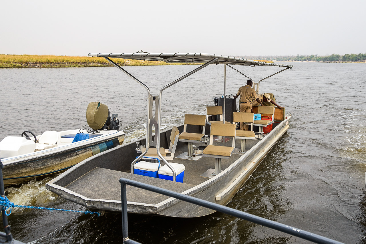
The entire complex is embedded in a tropical garden with many beautiful plants to be admired. From the receptions, a path leads down to the restaurant, the bar and the viewing terrace. The excursion boats are moored further down by the river - two smaller boats and the large barge that can take about 40 guests.
From Divundu, follow the C48 in the direction of Botswana. After a few kilometers, a signposted sandy path leads to the lodge, which can be reached in a few minutes.
The long, narrow strip of land known as Caprivi owes its form to the typical treaties of colonial times. The territory was transferred from the Brits to the Germans, who in exchange gave up their interest in Zanzibar to the Brits. The Germans wanted to create a west-east link between their Namibian and Tanzanian territories, but it never worked.
The administrative region was renamed Zambezi in 2013, but it is still widely known as Caprivi. Apart from its capital, Katima Mulilo, there are no other large settlements here. Separatist movements and guerrilla forces from Angola made it very difficult to access the region for years, but this problem has now been solved.
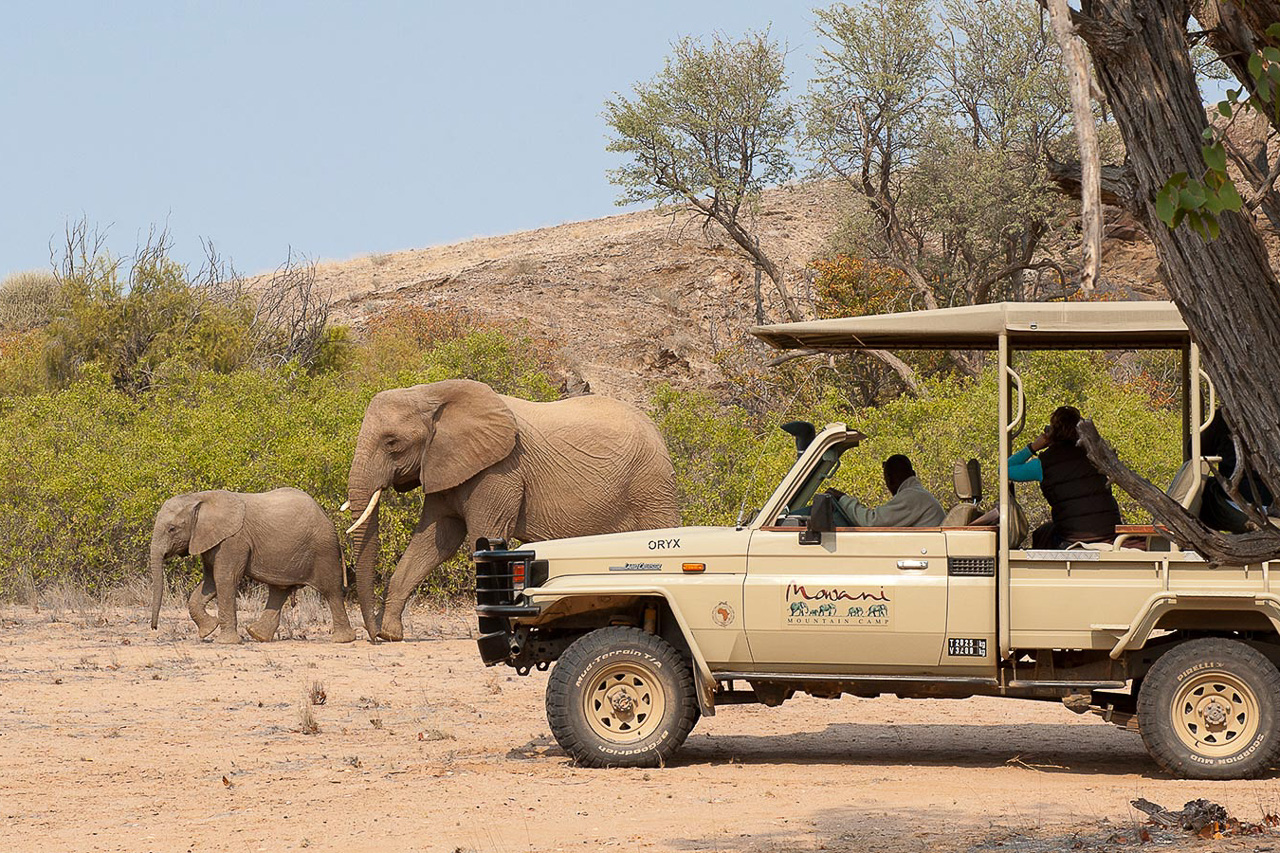
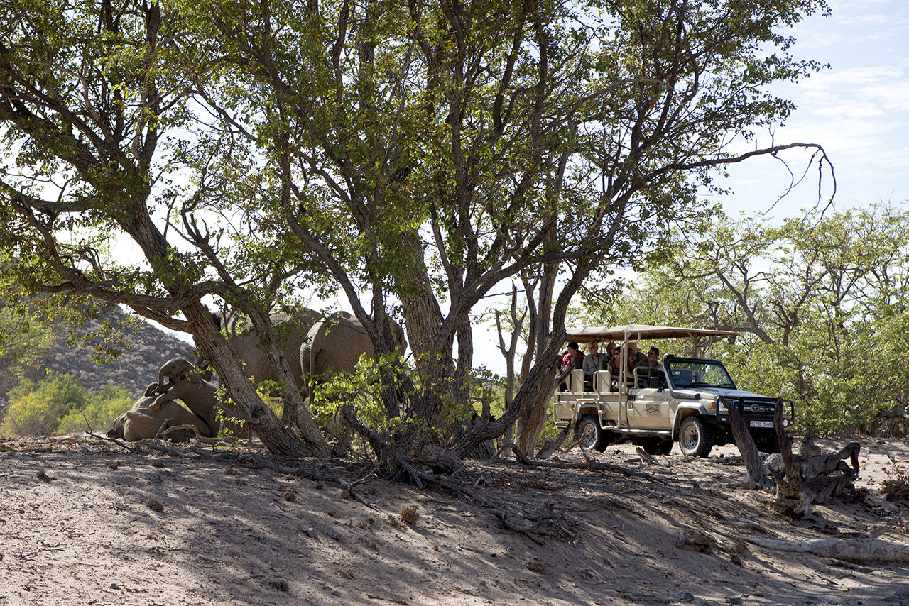
A visit to Caprivi requires a good, deep breath, as the route from Etosha through Caprivi to Victoria Falls is long. For this reason, we recommend breaking your trip with visits to several game reserves along the way. There are a number of parks here that are the counter part of those in the Linyanti region of Botswana. It is a kind of Okavango Delta experience, but with camps and safaris that are not quite on a par with those in Botswana but considerably less expensive.


Accommodation
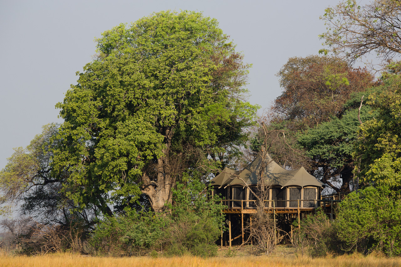
The ten tented suites at Nambwa Lodge are built on raised platforms on a wooded island near the Kwando River. The suites offer around 110m² of space and are equipped with a large king-size bed, a lounge with coffee station and an en-suite bathroom with toilet and shower.
All suites are connected to the main building via raised walkways. The lounge, dining area, fireplace, small library, souvenir store and bar are all located here. Meals are usually taken on the large deck under shady trees with a view of the waterhole in front of the lodge. A swimming pool is available as well.
The lodge is located approximately 10km south of Kongola. Follow the B8 from Kongola Bridge xfor a few minutes in a westerly direction and then turn south into the park. Please register at the park gate and then follow the signposts to Nambwa Lodge. The drive to the lodge takes about 30 minutes and is on sandy tracks. A 4×4 vehicle is mandatory.

Accommodation
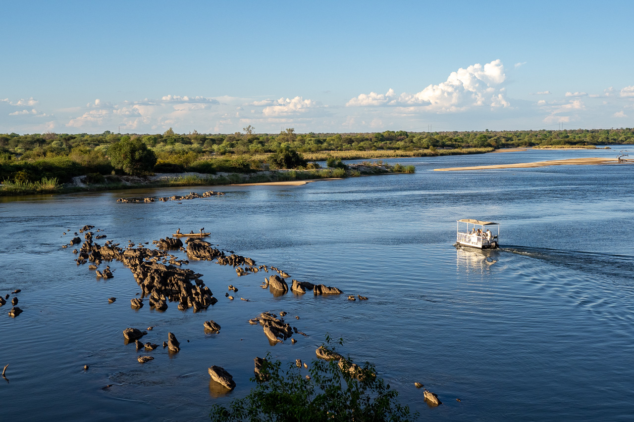
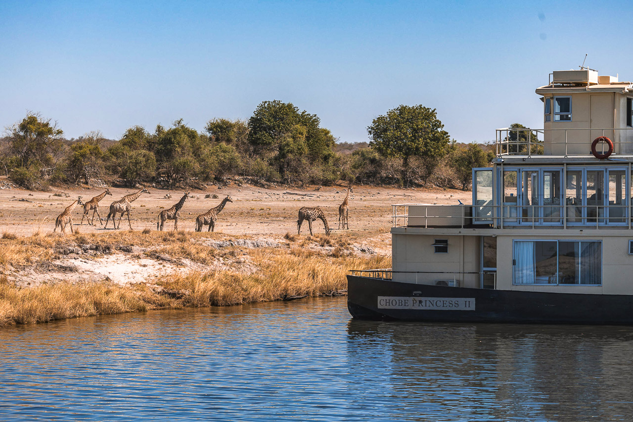
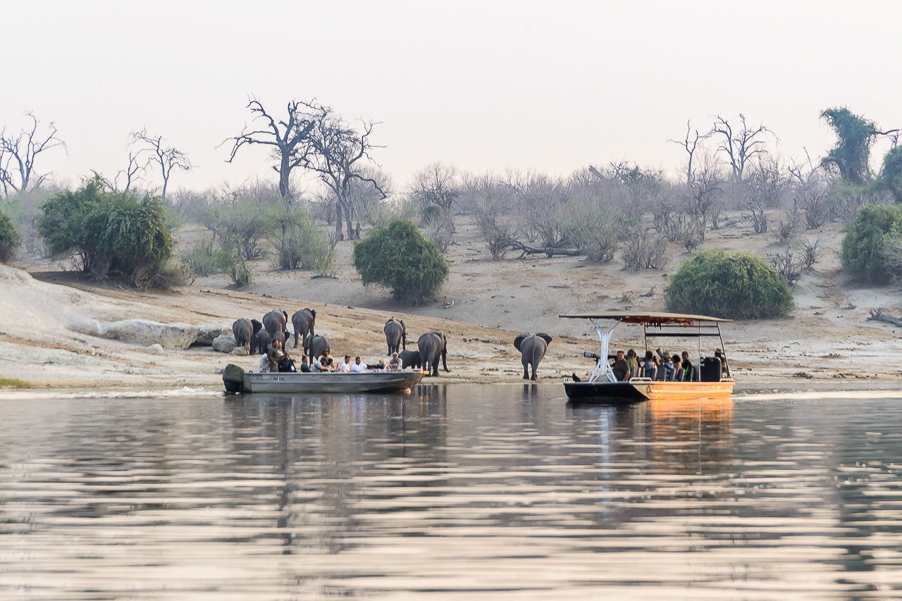
The Chobe Princess Safariboats are intimate houseboats on the Chobe River that allow guests to experience the wonders of the Chobe National Park without the crowds. The boats follow a schedule, with a 2-day departure on mondays and wednesdays and a 3-day departure on fridays. The boat is basically your private floating hotel on the Chobe River with staff, guides and boats at your disposal.
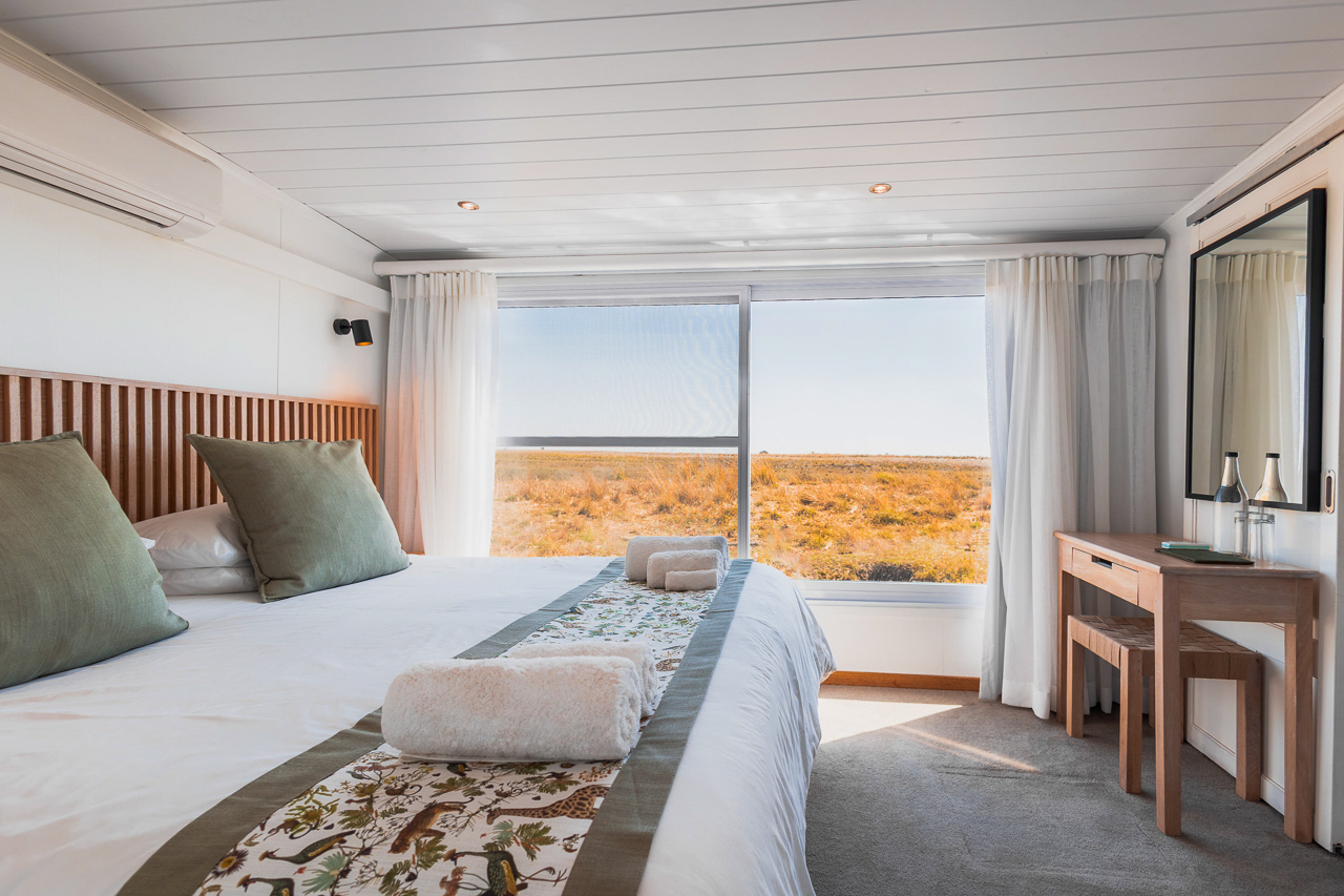
There are three boats, built to the same specifications. The boats offer 4-5 cabins, each configured with either a king size bed or a twin. All rooms can accommodate two adults and are equipped with large sliding windows and en-suite bathroom. Children of any age are allowed on the boat, and triples are possible for one child under 8 in the parent's room. The superior rooms are slightly more expensive as they offer a private balcony.
The Chobe Princess Safariboats consist of 3 decks. The cabins for guests and staff are located on the lower deck. The upper deck features bar, lounge and dining area. In front of the boat there is a sun deck with loungers and a plunge pool. The top deck is the perfect viewing point to watch wildlife while the sun sets over the Chobe River.
This border posts opens at 07h30 and closes at 16h30 daily. Guests should meet at Immigration at 13:30. After having your passport stamped, it is only a short boat ride across the river to Impalila Island to enter into Namibia (another stamp!). The whole transfer should not take more than 45 min from the jetty, or one hour from Kasane airport respectively. On your day of departure you will be taken back to Botswana, your arrival time at the Kasane border post (jetty) is about 10 am.
The Chobe Princess Safariboats have access to several exclusive docking sites along the Chobe River. It will take the boat between 3 and 4 hours to move from one site to the next.

Accommodation
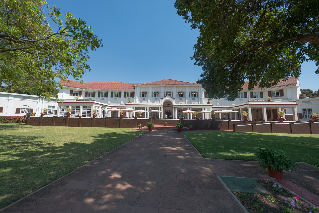
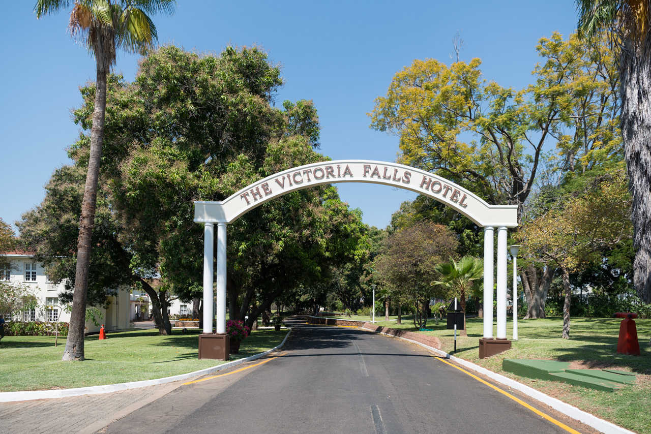
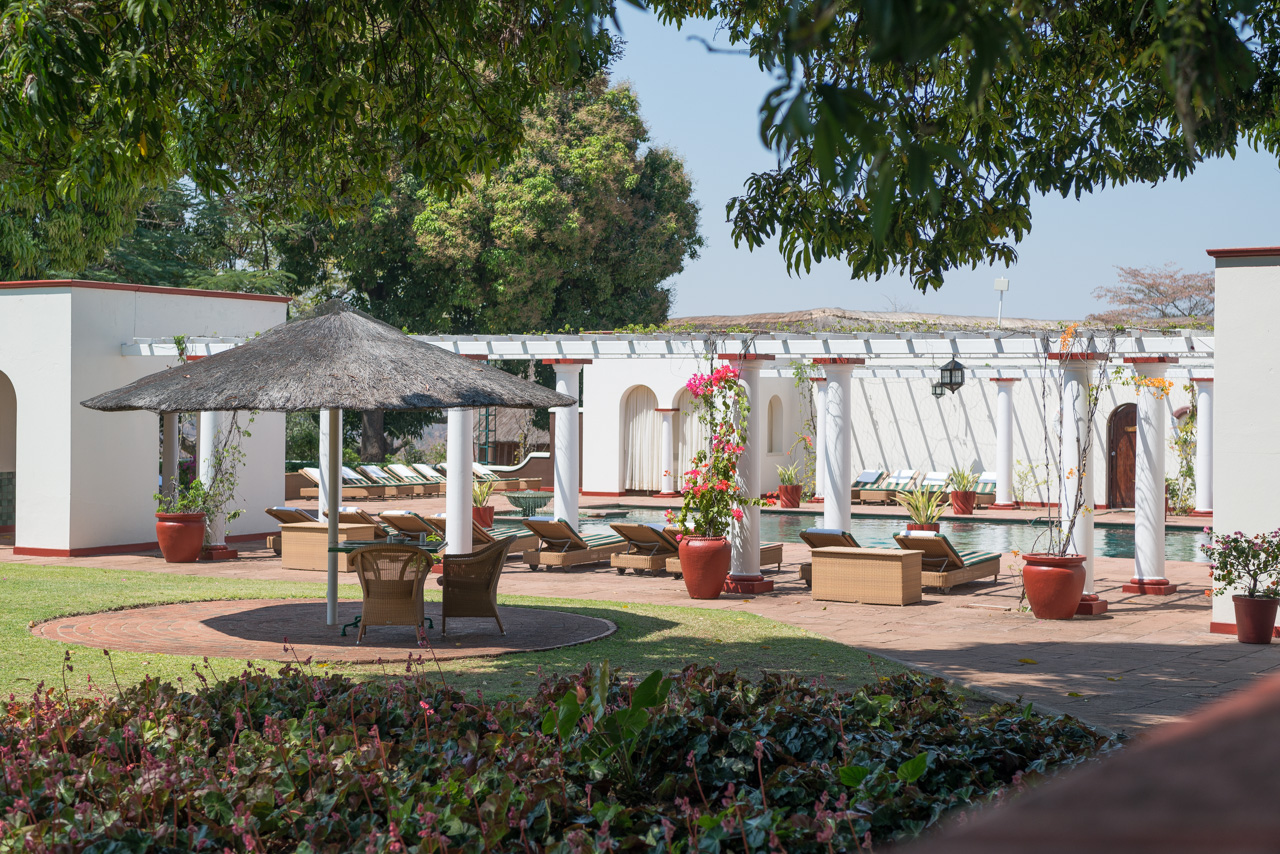
Witness to its own fair share of history, the Victoria Falls Hotel was built in 1904 during the reign of England's King Edward VII, and reflects the opulent Edwardian style. Monarchs, Presidents, Hollywood stars and other VIPs have all strut the corridors of this ‘grand old lady of the falls'. The hotel was just recently renovated in a manner still echoing its glorious past.
The well-manicured tropical garden with its water lily pond and shady palms offers first-rate views of the Victoria Falls and the historical bridge connecting Zimbabwe and Zambia. The hotel comprises 94 rooms of varying price class, three restaurants, two tennis courts, a large swimming pool, library, bar, spa with hair salon and a souvenir shop.
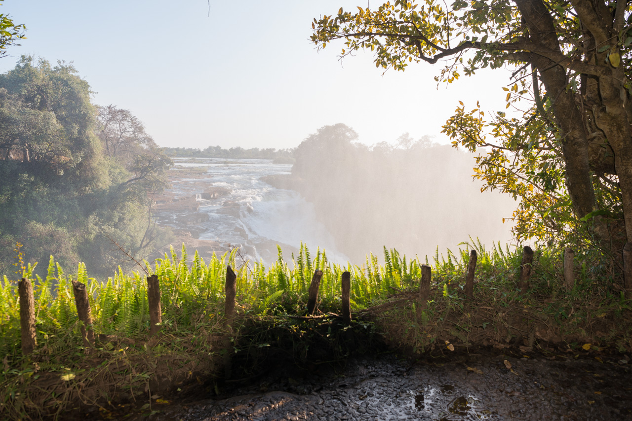
The Zambezi River rises in north-western Zambia and crosses several African countries on its 2700 km journey to the Indian Ocean. The river also forms the border between Zambia and Zimbabwe. At Victoria Falls, the water falls for more than 100m into Batoka Gorge, over a width of nearly two kilometers. The falls are called 'Mosi-oa-Tunya' or 'the Smoke that Thunders', as the spray can be seen from miles away and, at the height of the rainy season, more than five hundred million cubic meters of water per minute plummet over the edge.
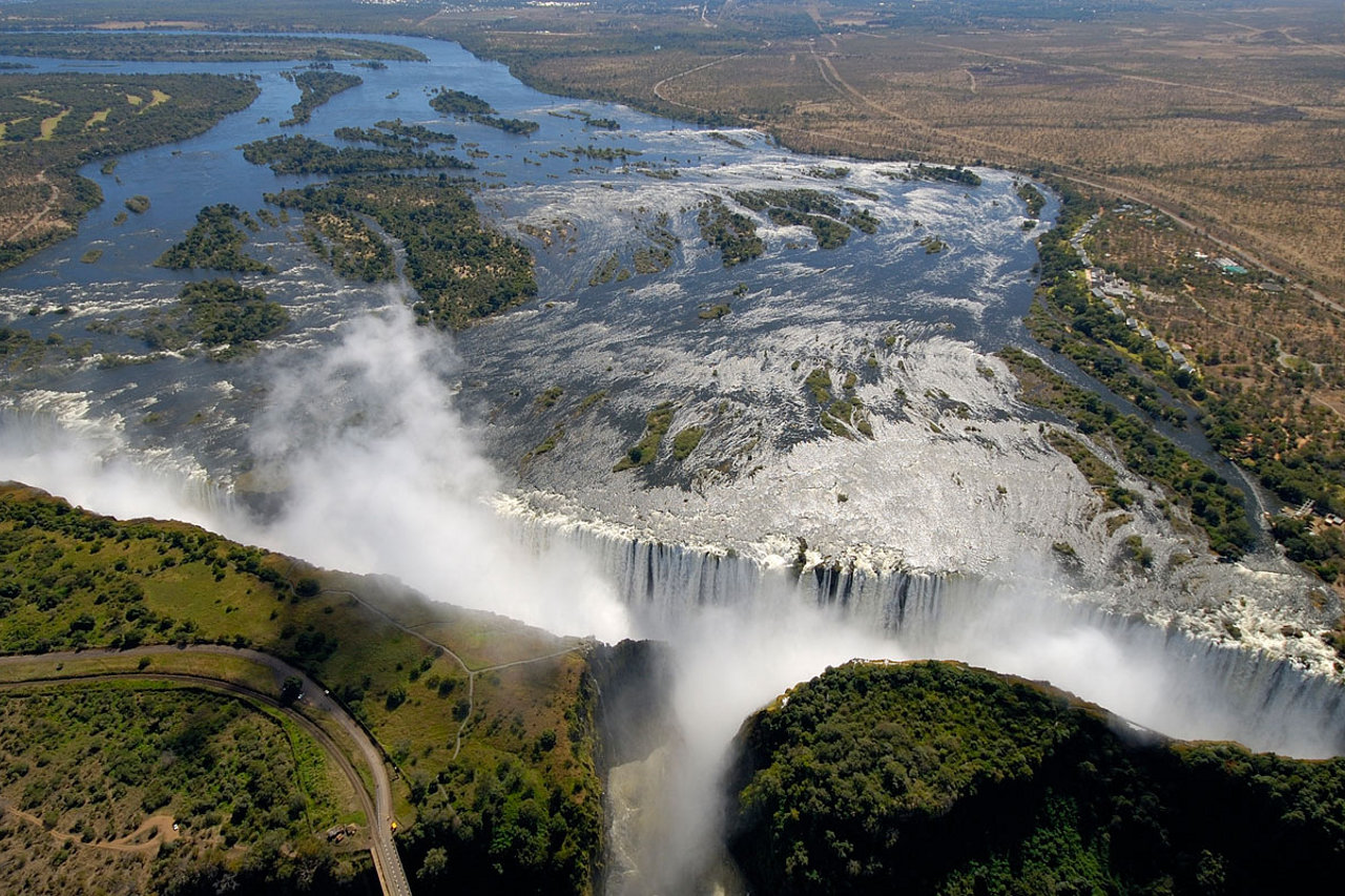
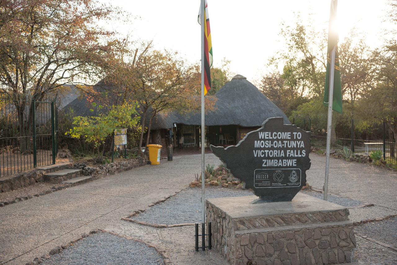
The town of Victoria Falls is located right next to the falls. The falls are called ‘Mosi-oa-Tunya’ or ‘The Smoke that Thunders’ because the mist can rise several hundred metres above the gorge during the wet season, making it visible for miles around and thus a well-known landmark.
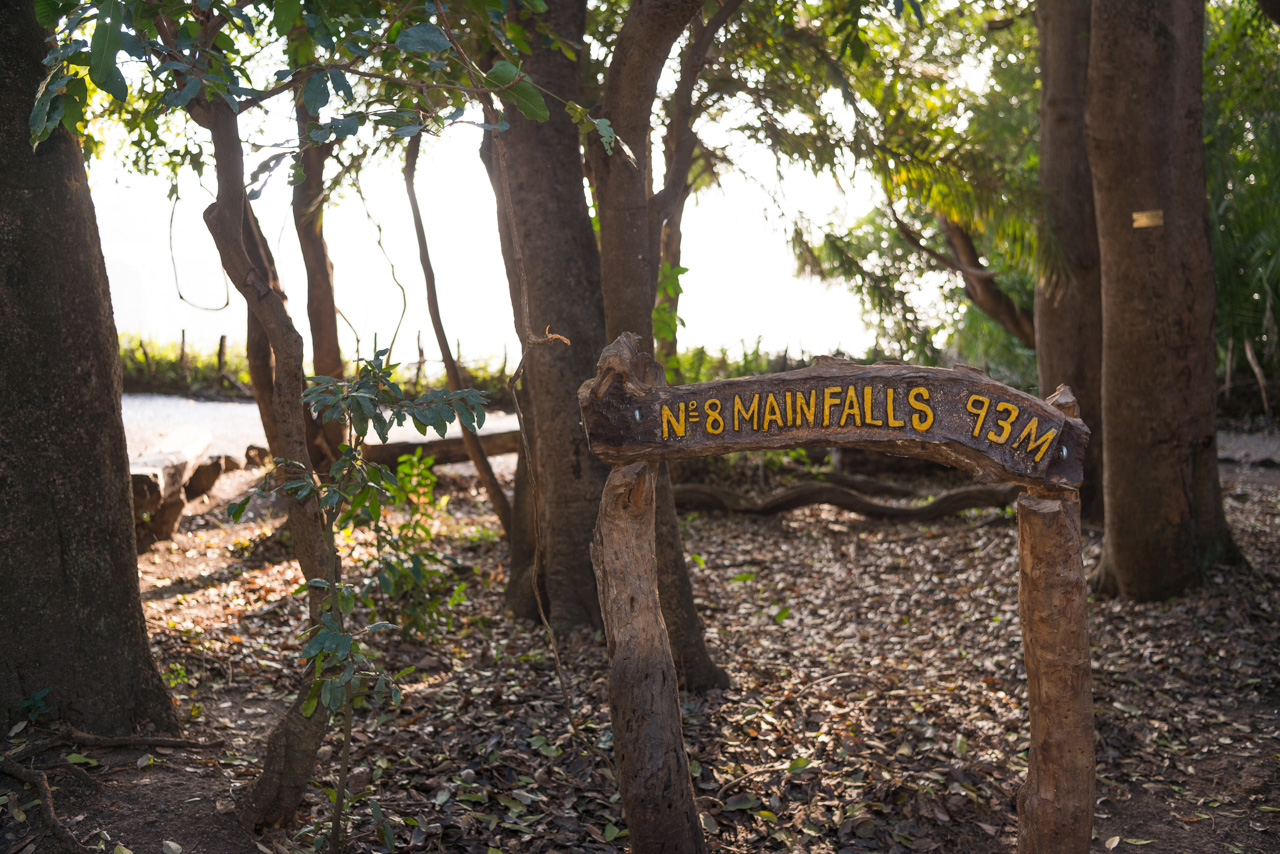
The town of Victoria Falls is the ideal place from which to explore the falls. For a small fee, guests can walk along the entire length of the falls on the Zimbabwean side, and marvel at the thundering mass of water.
The falls are rather small in October / November and large parts of the edge are visible. The amount of water flowing over the edge increases as the rains begin, swelling to its full capacity with the onset of the floodwaters in March / April. There is often a lot of mist from April to July, and it’s advisable to protect yourself and your camera with something waterproof.
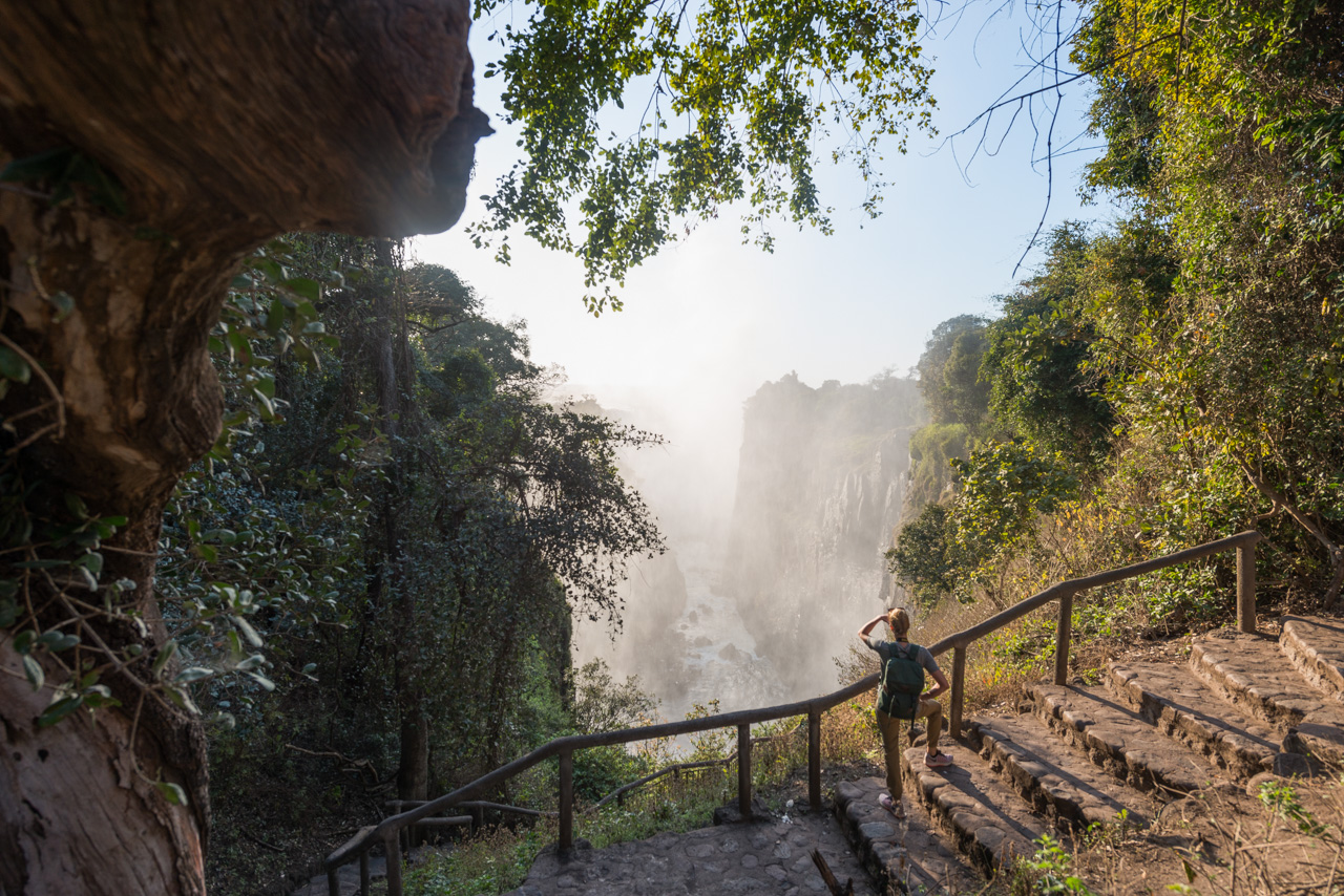
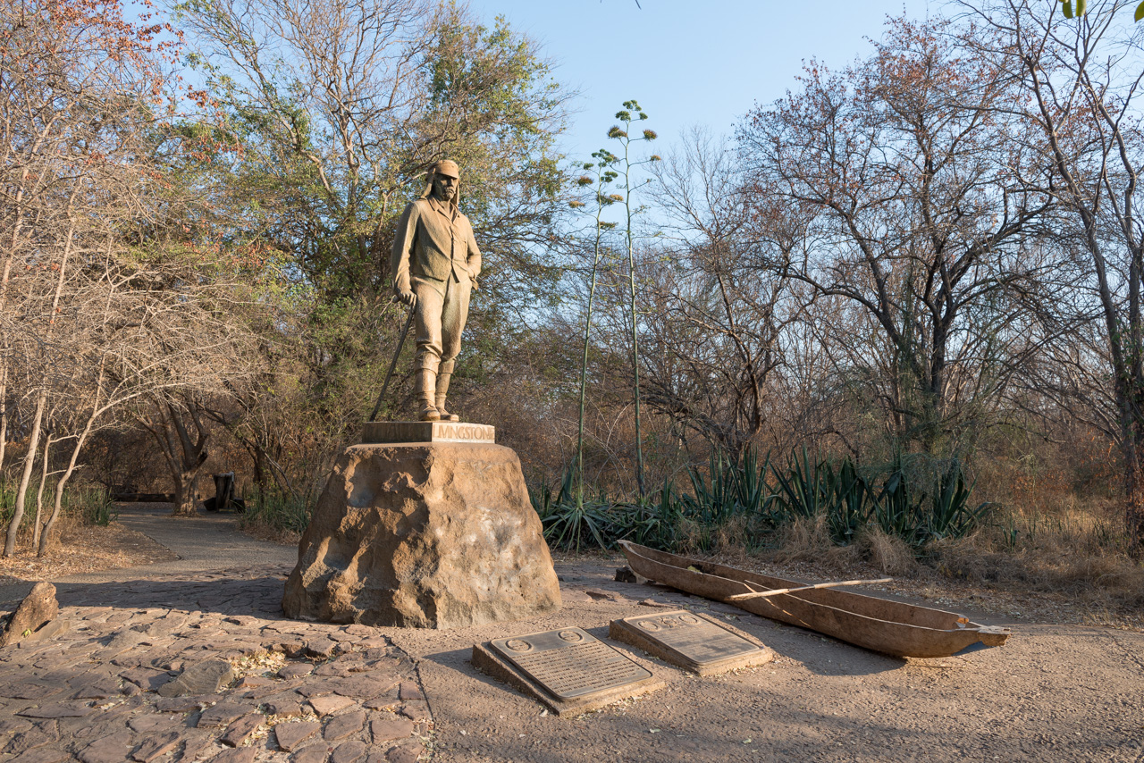
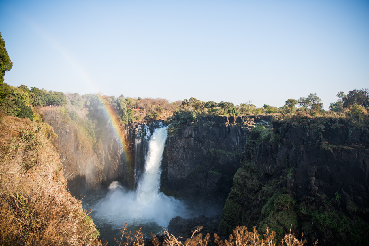
On the Zimbabwe side you can photograph and admire the entire waterfall from various vantage points. You may also like to visit the historic bridge, which the English had built over Batoka Gorge when they tried to establish a railway line from Cape Town to Cairo.


Basic Information
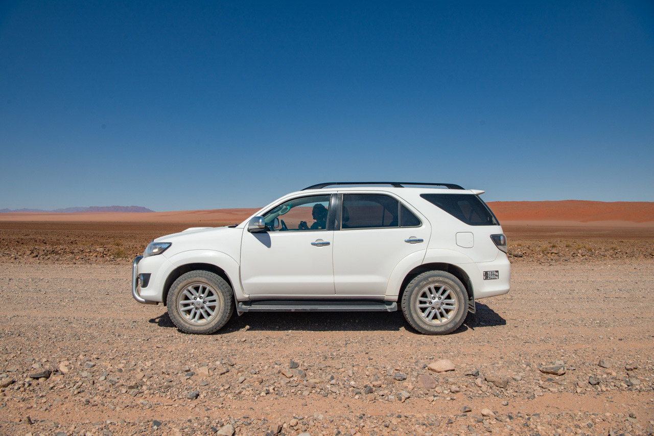
Individual journey. The journey will be planned on your preferred dates. Self-Drive a rented vehicle.
Duration 20 nights. Min 2 guests. Minimum age 6 years.
Includes all transfers from Windhoek to the hotels/camps to Victoria Falls
- Olive Grove: Luxury Room. Breakfast.
- Dead Valley Lodge: Double Room. All meals.
- Strand Hotel: Luxury Room. Breakfast.
- Camp Kipwe: Double Room. Dinner, breakfast. includes an Elephant Drive. Visit the Rock Engravings of Twyfelfontein independently.
- Etosha Oberland Lodge: Double Room. Dinner, breakfast.
- Onguma Tented Camp: Double Room. All meals, drinks (except premier brands), laundry service, twice daily shared activities with one of the camp guides.
- Divava Okavango Lodge: Double Room. Dinner, breakfast. Boat trips can be booked on arrival
- Nambwa Lodge: Double Room. All meals, drinks (except premier brands), twice daily shared activities with one of the camp guides.
- Chobe Princess: Standard Room. All meals, drinks (except premier brands), twice daily shared activities with one of the camp guides.
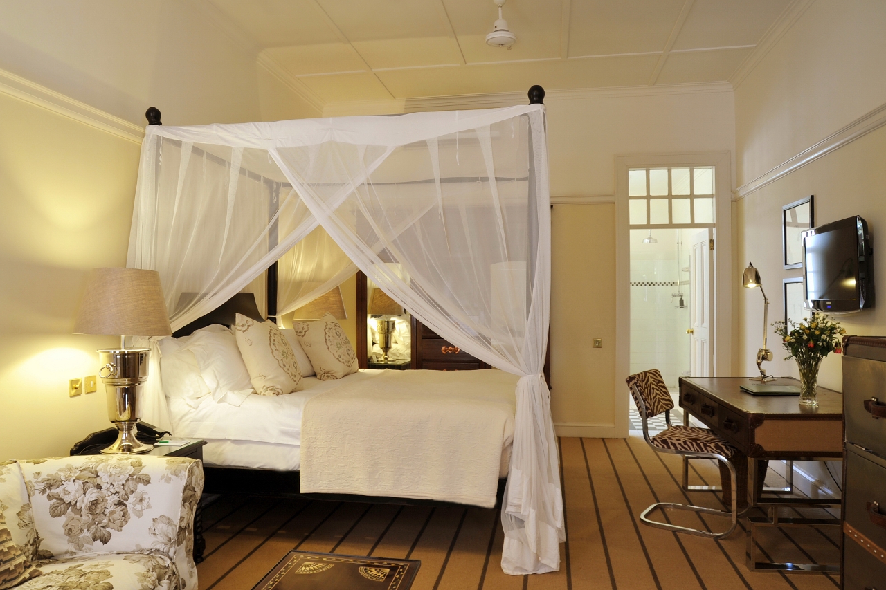
- Victoria Falls Hotel: Classic Room. Breakfast. Visit the Victoria Falls on your own. Helicopter trips, boat trips on the Zambezi, etc. are extra.
Learn more about these areas